0330L-WEDNESDAY OUTLOOK FROM GARFIELD COUNTY EMERGENCY MANAGEMENT-12/23/20
“WIND ADVISORY” IN EFFECT FROM 10 AM THIS MORNING UNTIL 6 PM THIS EVENING- NW winds 25-35 mph with wind gusts of 40 to over 50 mph are expected. SECURE ANYTHING that could take flight. Use extreme caution under trees that may have loose or weakened limbs as they may fall unexpectedly.
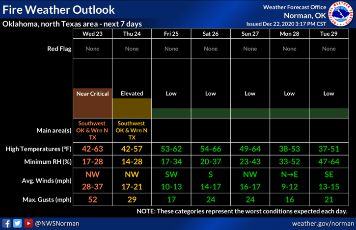
1- ELEVATED TO NEAR CRITICAL FIRE WEATHER CONDITIONS EXPECTED TODAY- All city and county departments will be briefed early this morning. Low humidity and high winds will be the main issues today. As stated yesterday if you see arcing power lines call OGE Immediately. If there is fire, call 911 so a quick response can be dispatched. Any fire that starts will move rapidly so that call to 911 is extremely important.
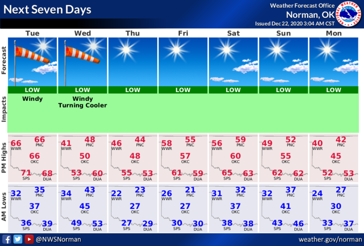
2- It will be getting quite a bit cooler today as colder air filters in from the cold front that will push through this morning. We may be down into the upper 30s by early evening. Take a coat with you to work!
3- Overall, we’ll be ok but it will cool down rather quickly. Here is your forecast from the NWS/NORMAN;
Today-Mostly sunny, windy, & cooler. Highs in the upper 40s. Northwest winds 25 to 35 mph with gusts up to 50 mph in the afternoon.
Tonight-Clear and colder. Lows in the lower 20s. Northwest winds 10 to 20 mph gusting to 35mph.
4- I will be sending a GARFIELD COUNTY EM app advisory out to all responders around 730am. If needed, I will send one over the public channel after that one is sent. The NWS has already sent theirs for the Wind Advisory over our app.
Have a good day!
MIKE