0400L: TUESDAY FROM GARFIELD COUNTY EMERGENCY MANAGEMENT
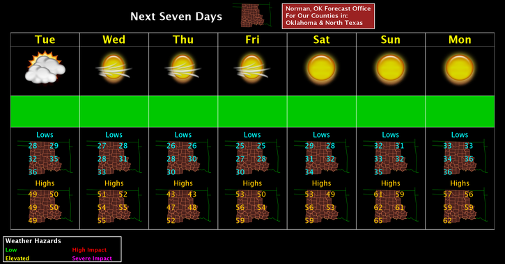
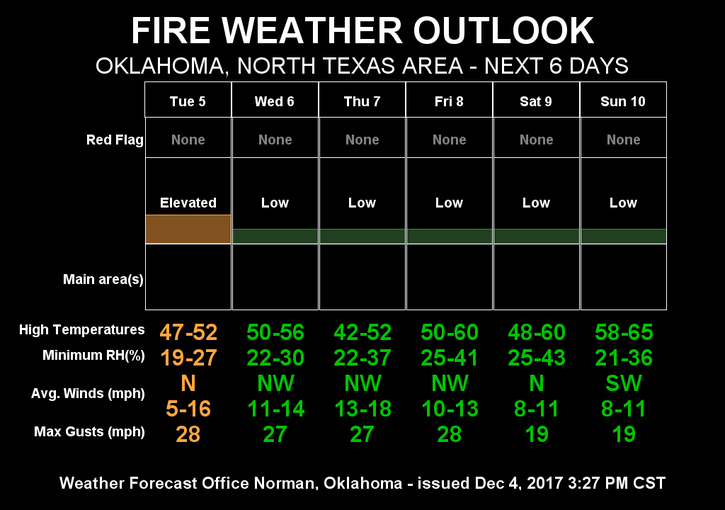
COLDER is the word for this week. Highs all week will average from the upper 40’s to upper 50’s with THURSDAY’S high in the LOW 40’s. Overall, just a cool week. The HUMIDITY at this time of day is usually high. Right now at 0355 Local time, it’s 23% with a Dew point of 2.7 degrees, very very dry. This basically means the FIRE DANGER IS ELEVATED so be EXTREMELY careful utilizing anything related to fire. Report any smoke or fire that you observe to 911 and they will get the proper response moving.
Here is your forecast from the NWS/NORMAN;
Tuesday-Cloudy, then gradually becoming mostly sunny, with a high near 49. North wind 8 to 13 mph becoming west in the afternoon.
Tuesday Night-Clear, with a low around 27. West wind 6 to 9 mph.
Be sure to download our emergency app-GARFIELD COUNTY EM.
HAVE A SUPER DAY!!
MIKE