0250L-TUESDAY OUTLOOK FROM GARFIELD COUNTY EMERGENCY MANAGEMENT 02/20/24
*The warming trend will continue but with increasing winds. As we continue this trend, the fire danger will increase. As it appears right now, a cold front will push in on Thursday but we’ll remain above normal on temps but winds will be quite strong out of the NNW. Use caution if working with anything related to fire.
*SPEAKING OF FIRE, controlled burning should not occur if winds are in excess of 15 mph. Also, if winds are nominal and you are going to burn, call dispatch so they will advise all fire personnel of that burn. Otherwise, we’ll come out and put it out. Final thing here is that you need to stay on scene while burning. Dispatch number is 580-234-FIRE (3473).
Overall, we’ll be ok so continue to enjoy the weather. Here is your forecast from the NWS/NORMAN;
Today- Sunny. Highs in the lower 70s. South winds 10 to 15 mph.
Tonight- Partly cloudy. Lows in the lower 40s. South winds 5 to 10 mph.
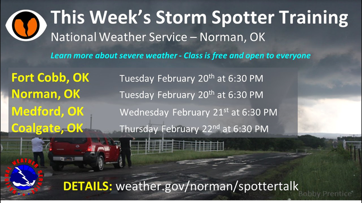
Finally, see the graphic below for storm spotter classes put on by the NWS. I will schedule several around the county soon.
HAVE A GOOD DAY!