0350L-TUESDAY OUTLOOK FROM ENID/GARFIELD COUNTY EMERGENCY MANAGEMENT-1/1/19
1-HAPPY NEW YEAR EVERYONE!! “COLD” IS THE WORD FOR TODAY
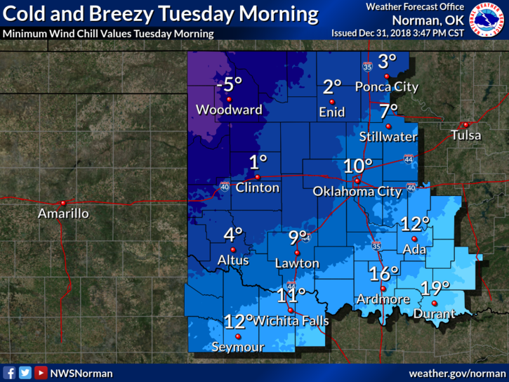
2–WIND CHILL ADVISORY OUT WEST UNTIL NOON TODAY.
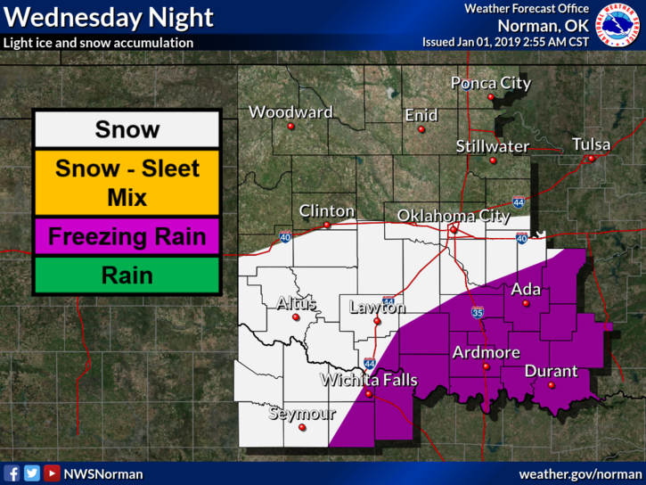
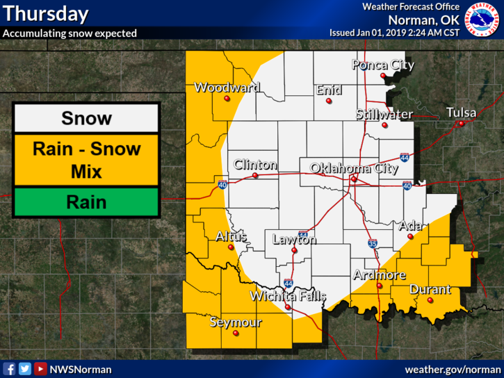
3- WINTER STORM WATCH JUST TO OUR SOUTH AND EAST FOR LATE WEDNESDAY INTO THURSDAY. RELAX, STAY CALM, AND WE WILL SURVIVE.
4- SEE GRAPHS BELOW AND READ CAREFULLY. These will change several more times as data modifies and becomes more reliable. Speed, actual storm track, and type of precipitation aren’t set in stone yet so please understand this.
5- Based on guidance as of 0300 local time this morning, we may see snow in our area. Not going to estimate anything until after our briefing this morning with the NWS/NORMAN. The update that will be sent out will come over our GARFIELD COUNTY EM app. Make sure you have it. Also, you can find this information on our website at gcem.org
6. Here is your forecast for today from the NWS/NORMAN;
New Year’s Day- Partly sunny with a high near 27. North wind 10 to 20 mph, with gusts as high as 25 mph.
Tuesday Night- Partly cloudy with a low around 15. North wind 5 to 10 mph.
HAVE A SUPER DAY, DON’T RUSH THE GROCERY STORES, AND STAY WARM.
BREATHE DEEPLY AND RELAX.
MIKE