TUESDAY OUTLOOK FROM GARFIELD COUNTY EMERGENCY MANAGEMENT 01/30/24
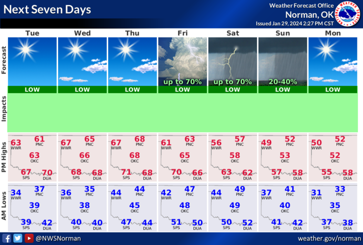
*Get ready for another nice day. The weather should stay a lot like yesterday for the week until Friday afternoon when rain returns to the area. The only thing today is that winds will be northwesterly around 5 to 10 mph along with sunshine. Winds will become southerly on Wednesday.
*For this weekend, as stated above, rain chances increase Friday afternoon through Saturday and should end on Sunday when a cold front pushes in. This cold front will bring us back down to average temperatures for this time of year. We should stay above freezing so any precip should remain liquid. Also, the storm track for the Friday/Saturday storms is not set in stone yet as models are not in total agreement. We’ll see how all of that pans out.
*Overall, we’ll be ok so enjoy the day. Here is your forecast from the NWS/NORMAN;
Today- Sunny. Highs in the mid-60s. Northwest winds around 5 mph.
Tonight- Mostly clear. Lows in the upper 30s. West winds around 5 mph, becoming south around 5 mph after midnight.
HAVE A GOOD DAY!