0410L-TUESDAY OUTLOOK & INFO FROM GARFIELD CO. EMERGENCY MGMT-7/14/2020
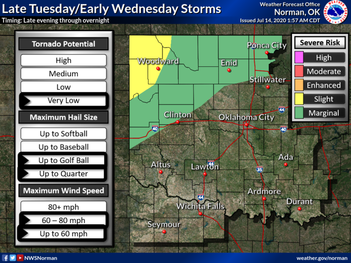
1-MARGINAL RISK FOR SEVERE WEATHER late this evening and overnight. Winds in excess of 70 mph & Golf Ball size hail are the main threats.
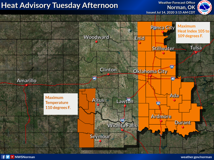
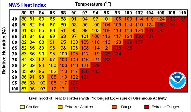
2- HEAT ADVISORY IN EFFECT FROM 1 PM- 8PM TODAY. HEAT INDEX FROM 105-109 POSSIBLE. Here is your forecast from the NWS/NORMAN;
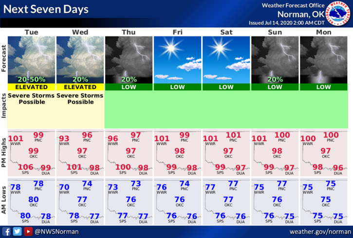
TODAY-30% chance of showers and t-storms mainly before 7am. Mostly sunny and hot with a high near 101. Heat index values as high as 107. SSE winds 10 to 15 mph gusting to 20 mph.
TONIGHT-30% chance of showers and t-storms. Increasing clouds with a low around 74. Southeast winds 10 to 15 mph becoming north after midnight. Winds could gust as high as 21 mph.
DIRECTORS COMMENT
First, THANK YOU for your comments on my social media pages last night. This helps in the decision making process.
Be sure and get our GARFIELD COUNTY EM app. IF YOU HAVE TROUBLE with the app, let me know before we have storms as during an event, I don’t have time to help you through issues. Each phone is different depending on your settings. I will try to do a short video in the near future to show everyone how it works.
SEVERE WEATHER happens. There is no reason to be freaked out every time we have storms. There is nothing we can do about them other than BEING PREPARED, NOT SCARED. The folks on TV want to scare you into viewing but that mostly will increase your blood pressure and anxiety. Do what you will but understand; torrential rainfall, possibly hail, high winds, and if conditions and the atmosphere are just right, tornadoes can occur. Again, being prepared, not scared is understanding all those conditions happening during a severe weather event.
In the coming weeks, I will explain these various conditions so you have a better understanding of what’s going on.
HAVE A GOOD DAY
MIKE