0355L-TUESDAY OUTLOOK & INFO FROM GARFIELD COUNTY EMERGENCY MGMT-6/16/2020
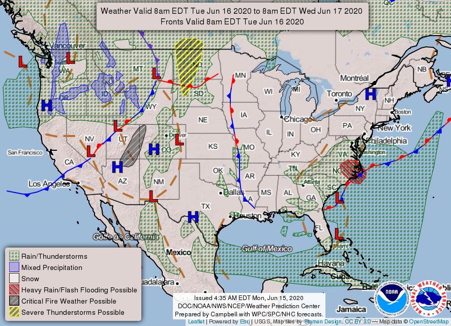
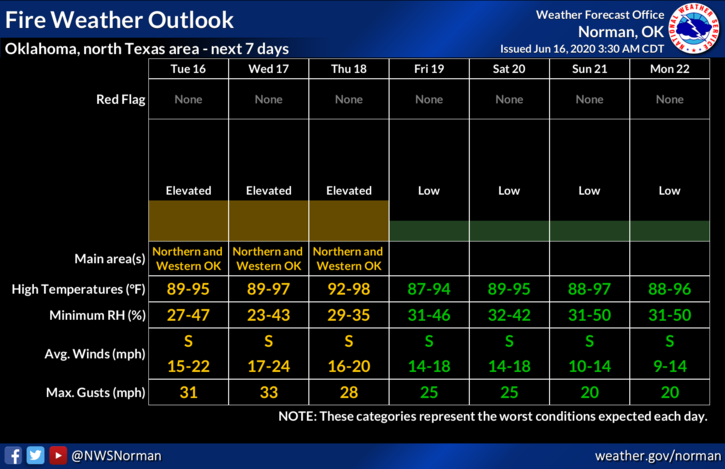
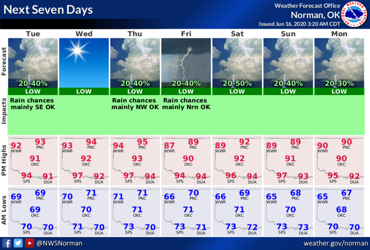
1- HOT AND DRY with an elevated FIRE WEATHER concern. Today will feel like yesterday and relief isn’t here yet. Per model guidance the CHANCE for rain Thursday through the weekend has gone up to 30%. Based on what I have read our rain chances COULD come mostly overnight. We’ll see what happens as model guidance hopefully comes together. We definitely need the rain.
2- Here is your forecast from the NWS/NORMAN;
Tuesday-Mostly sunny with highs in the mid-90s. South winds 10 to 20 mph gusting to 25 mph.
Tuesday Night-Mostly clear with a low around 70. South southeast winds 10 to 15 mph, with gusts as high as 21 mph.
3- I think most folks realize the fire danger issue going on right now. The first fire we fought yesterday was pretty intense and was difficult to fight along the north end (CARRIER ROAD) due to 15-20 foot high flames THEN we had folks driving around us causing a very dangerous situation as we couldn’t maneuver trucks along the road. IF THERE IS A FIRE, STAY AWAY. YOU PUT OUR FIREFIGHTERS IN DANGER.
Finally, I want to thank all firefighters yesterday on their efforts. While we were on the Enid fire, Lahoma and Drummond were out on another fire assisting in Major County. They returned safely around 6:30 to 7 pm I believe. We assisted Major County last week and over the weekend in getting fires under control in the Ames area. Just remember this, it’s YOUR tax dollars that has allowed us to purchase up to date equipment to respond quickly, to acquire training for fire and rescue operations, for your peace of mind knowing that if you need help, we’ll be there wherever you are in our county, and finally if surrounding counties need help, we’ll be there to assist them upon request. We’re here for you as this is why we do what we do.
HAVE A SUPER DAY!!
MIKE