0400L-TUESDAY UPDATE FROM ENID/GARFIELD COUNTY EMERGENCY MANAGEMENT-6/26/18
1-WOW!! Actually got some sleep last night! This is a good thing. Bad thing is the HEAT is going to return and the heat index will definitely rise.
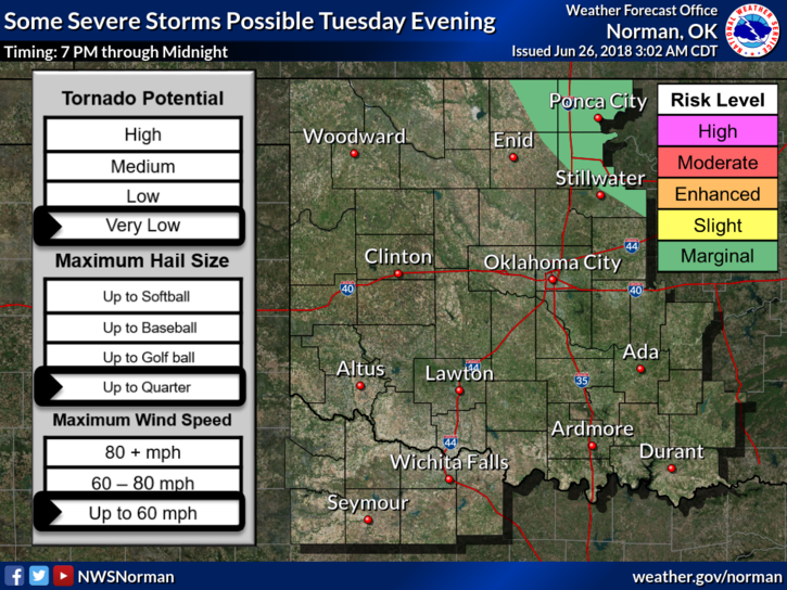
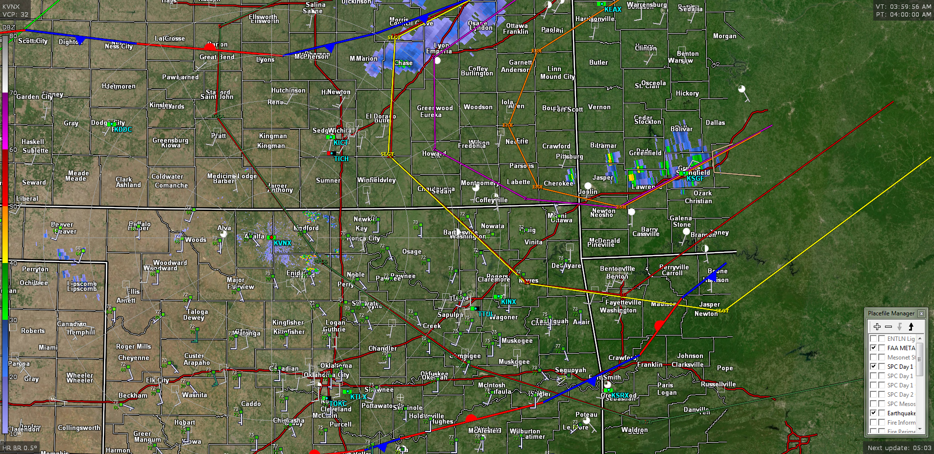
2-We are in a GENERAL RISK for storms today but chances are very low. We are on the far western periphery of a MARGINAL RISK so until tomorrow, we won’t be totally out of the woods. We’ll see how that mess comes together later today. The attached radar pic shows where these lines are along with the Slight and Enhanced risks are to our northeast.
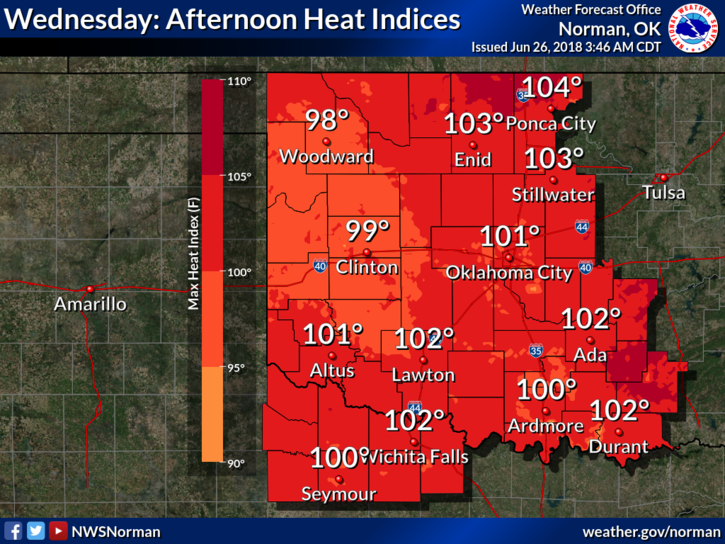
3- High temps this week will average around 97 to 100 or so and the heat index will average 100 to 104. Remember, this will change some so don’t hold me to these exact numbers. Either way, it’s going to be extremely hot outside so BE CAREFUL while working.
4-Here is your forecast from the NWS/NORMAN ;
Tuesday-Sunny with highs near 94. Heat index values around 100. South southwest winds 10 to 20 mph gusting to 25 mph.
Tuesday Night-Partly cloudy with lows around 74. South winds 10 to 15 mph gusting to 20 mph.
HAVE A GREAT DAY!!
MIKE