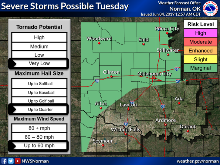
0350L-TUESDAY OUTLOOK FROM GARFIELD COUNTY EMERGENCY MANAGEMENT-6/4/19
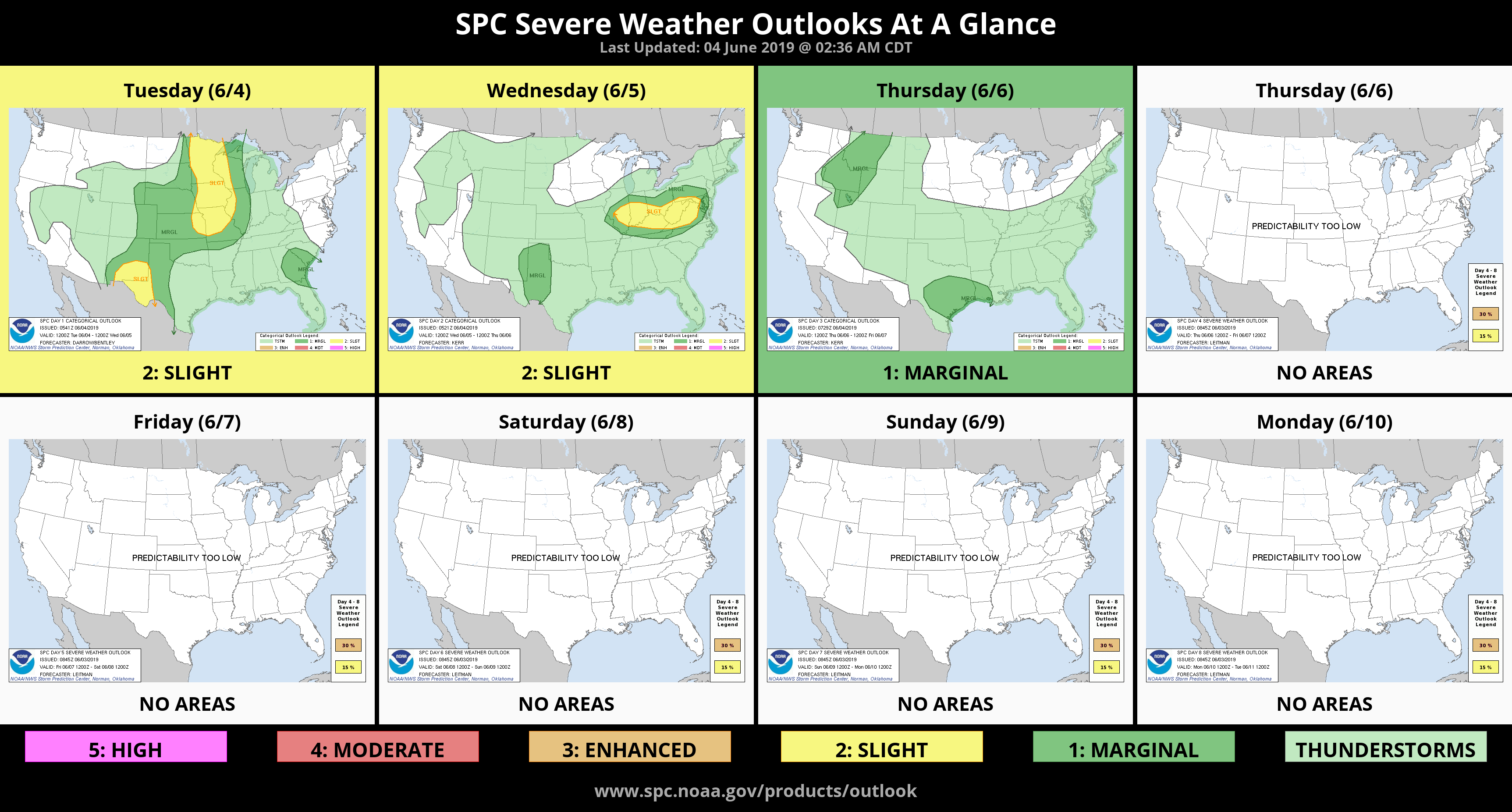
1- We are in a MARGINAL RISK for severe weather today and this evening. See graph attached.
2- On our GARFIELD COUNTY EM app, I have included “Significant Weather Advisories” along with any warnings that the NWS puts out for our area. I have added this because it gives you a heads up that significant weather is approaching the area along with LOCAL information from our operations center. As stated in previous posts, you’re better prepared with our app than without it.
3- Thunderstorms will occur off and on into the weekend so just be prepared and always know, we are watching!!
4- Here is your forecast from the NWS/NORMAN;
Tuesday- Partly cloudy with a slight chance of thunderstorms. Highs in the upper 80s. South winds 10 to 15 mph. Chance of thunderstorms 20 percent.
Tuesday Night-Partly cloudy with a slight chance of thunderstorms. Lows in the mid-60s. South winds 10 to 15 mph. Chance of thunderstorms 20 percent.
HAVE A GOOD DAY!!
MIKE