0400L-TUESDAY OUTLOOK & INFO FROM GARFIELD COUNTY EMERGENCY MGMT-3/10/2020
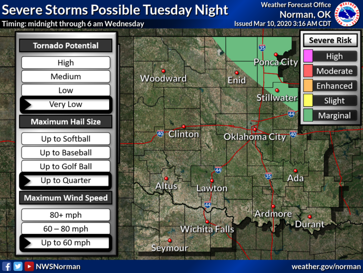
1- MARGINAL RISK FOR SEVERE WEATHER LATER TONIGHT. A surface low just to our west and another cold front are the culprits. Timing appears to be sometime after 11pm during the overnight hours. Hail and winds should be the main threats. This will change a little throughout the day so I’ll post again this afternoon as needed. I will send information over the GARFIELD COUNTY EM app.
2- If you haven’t done any planning and need information, you can find our Family Preparedness Guide here- https://gcem.org/wp-content/uploads/2019/05/FamilyPreparednessGuide2019.pdf
3- Be sure to download our GARFIELD COUNTY EM app. NWS warnings and advisories push through automatically as they are sent. You’re best prepared with it than without it.
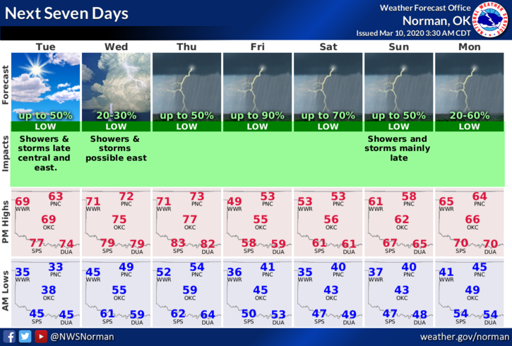
4- Here is your forecast from the NWS/NORMAN;
TODAY- Partly cloudy with highs in the mid-60s. Light and variable winds becoming southeast around 10 mph in the afternoon.
TONIGHT- Partly cloudy with a chance of thunderstorms after midnight. Not as cool. Lows in the upper 40s with southeast winds 10 to 15 mph. Chance of thunderstorms 50 percent.
HAVE A SUPER DAY!!
MIKE