0415L-TUESDAY UPDATE FROM ENID/GARFIELD COUNTY EMERGENCY MANAGEMENT-5/1/18
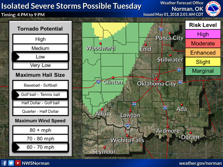
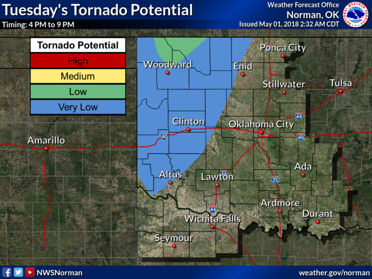
1-We are in a MARGINAL RISK for severe weather later today for our area. Going north into central Kansas isn’t a really good idea as they are in an Enhanced Risk that could be upgraded to a MODERATE Risk later today. That said the cap above us is preventing anything from happening as was seen yesterday as storms tried to push into the state and they “croaked,” new meteorological term, so to speak. This scenario will continue today as the focus area will be up north. This doesn’t mean things won’t happen out west or here but north is where the higher probabilities are.
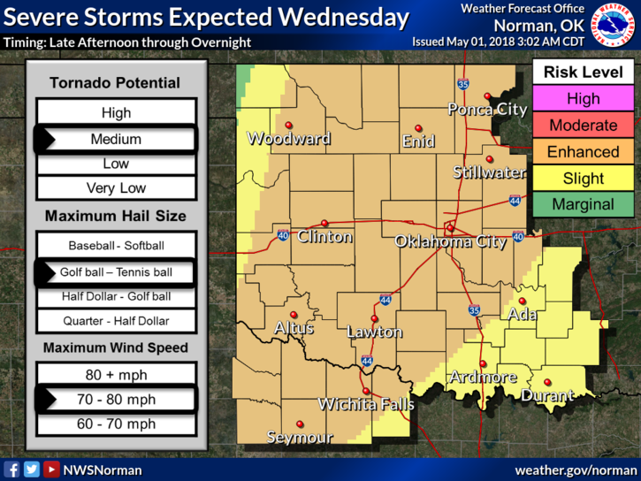
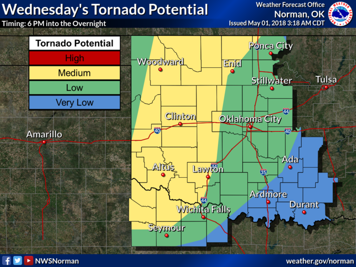
2- Tomorrow, location of the front, dryline, the strength of the cap, moisture return, and instability, are all factors on how, where, and when things will happen. We’ll wait and see how all this mess comes together.
3-Overall, don’t let all the hype cause you anxiety. Just be PREPARED and understand that the ingredients needed for a rough day on Wednesday “may” come together. If it does, we’ll deal with it and move on. Keep up with us on our GARFIELD COUNTY EM app and listen to our local radio stations. We all work together to give you needed information to protect you and yours.
4- The attached graphs will change some today and possibly for tomorrow. That’s normal so you can monitor these on the NWS website. Read them carefully as they do tell a story.
5- Here is your forecast for today from the NWS/NORMAN;
Tuesday-20 percent chance of showers and thunderstorms before 1pm. Cloudy with a high near 80. South winds 15 to 25 mph gusting to 35 mph.
Tuesday Night-Mostly cloudy, with a low around 69. South winds 15 to 25 mph gusting to 38 mph.
HAVE A SUPER DAY AND WE’LL ADVISE IF ANYTHING CHANGES.
MIKE