FROM GARFIELD COUNTY EMERGENCY MANAGEMENT
TODAY WILL BE A SEVERE WEATHER DAY. IF YOU PLAN ON GOING WEST OR SOUTHWEST, STAY UP WITH THE LATEST WEATHER INFORMATION. TIMING FOR GARFIELD COUNTY IS FROM 6PM UNTIL MIDNIGHT. KEEP IN MIND THAT TIMES WILL “NOT” BE EXACT.
1- YES, THERE WILL BE SEVERE WEATHER LATER TODAY IN THE AREA
2- YES, “ALL” WEATHER RISKS WILL BE A FACTOR TODAY IN SOME FORM
3- OUR SPOTTERS WILL BE PUT ON STANDBY ALERT STATUS THIS AFTERNOON
4- WINDS AND LARGE HAIL WILL BE A MAJOR FACTOR FOR US BESIDES RAINFALL
5- NO ONE CAN STOP THE WEATHER SO PREPARE NOW BEFORE THE STORMS FORM
6- AS I HAVE STATED FOR YEARS, PREPAREDNESS STARTS WITH YOU AND IS “YOUR” RESPONSIBILITY. HAVE A PLAN IN PLACE NOW.
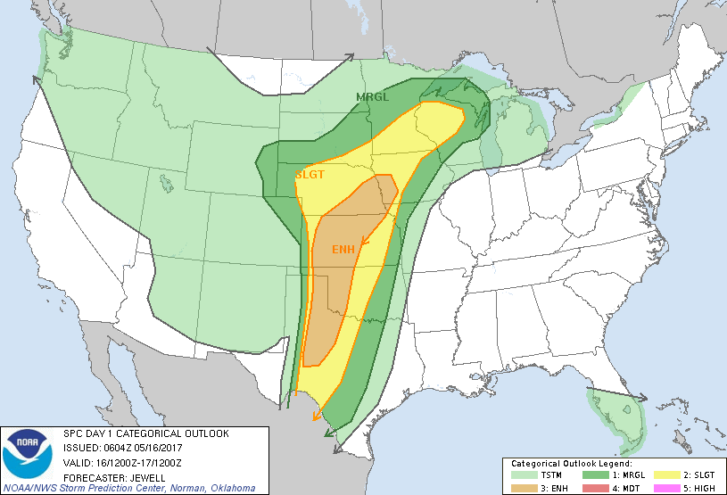
Back to normal print, we are in an ENHANCED RISK for severe weather later today. ALL weather risks may be involved. That said, you know what you need to do to protect you and your family so do so and make arrangements BEFORE storms occur. This way you don’t have to worry. OVERALL, we’ll be ok.
Download our “GARFIELD COUNTY EM” app and stay up to date from your WARNING AGENCY, G.C.E.M.
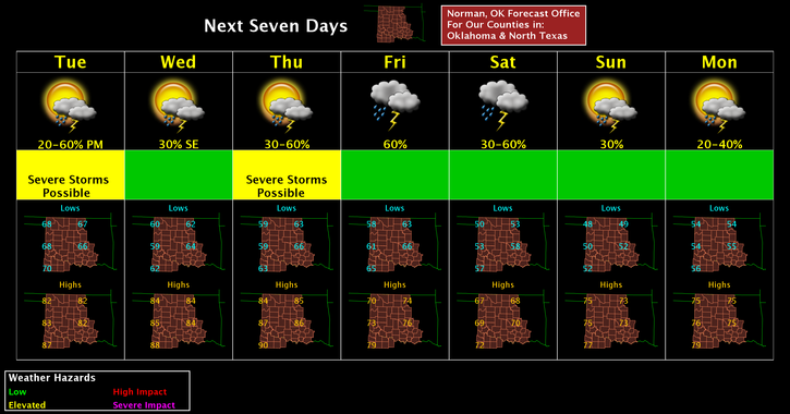
There is no need to panic as we face these issues from time to time. We’ll face these once again on Thursday into Friday so just expect some bumpy weather. Here is your forecast for today from the NWS/NORMAN;
Today-30 percent chance of showers and thunderstorms after 1pm. Some of the storms could be severe. Partly sunny, with a high near 82. South wind 14 to 20 mph, with gusts as high as 28 mph.
Tonight-Showers and thunderstorms likely. Mostly cloudy, with a low around 62. South wind 15 to 22 mph, with gusts as high as 31 mph. Chance of precipitation is 60%. New rainfall amounts between a tenth and quarter of an inch, except higher amounts possible in thunderstorms.
I’ll advise early this afternoon as needed.
MIKE