0330L-TUESDAY OUTLOOK FROM GARFIELD COUNTY EMERGENCY MANAGEMENT-5/24/22
FLOOD WATCH IN EFFECT UNTIL WEDNESDAY AT (0100) 1 AM.
Not trying to be funny but- Mosquito Watch in effect for the next several months. Make sure you have the proper repellent for you and your family. They’re already out there so be prepared to protect yourselves.
1- Here is your forecast from the NWS/NORMAN;
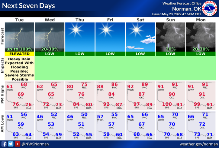
Tuesday-Showers and thunderstorms in the morning, then showers likely with a chance of thunderstorms in the afternoon. Some thunderstorms may produce heavy rainfall in the afternoon. Highs in the mid-60s. Southeast winds 5 to 10 mph. Chance of rain 90 percent.
Tuesday Night-Cloudy. A chance of showers and thunderstorms, mainly in the evening. Some thunderstorms may produce heavy rainfall. Lows in the lower 50s. Northeast winds 5 to 10 mph, becoming northwest after midnight. Chance of rain 50 percent.
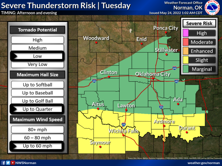
2- We are in a MARGINAL RISK for severe weather. If severe storms occur, expect strong winds, hail, and torrential rainfall. Per NWS guidance, this possibility could occur anywhere just south of an Elk City to Enid line. Keep in mind that this line may vary a bit. Just be prepared for heavy weather if it occurs.
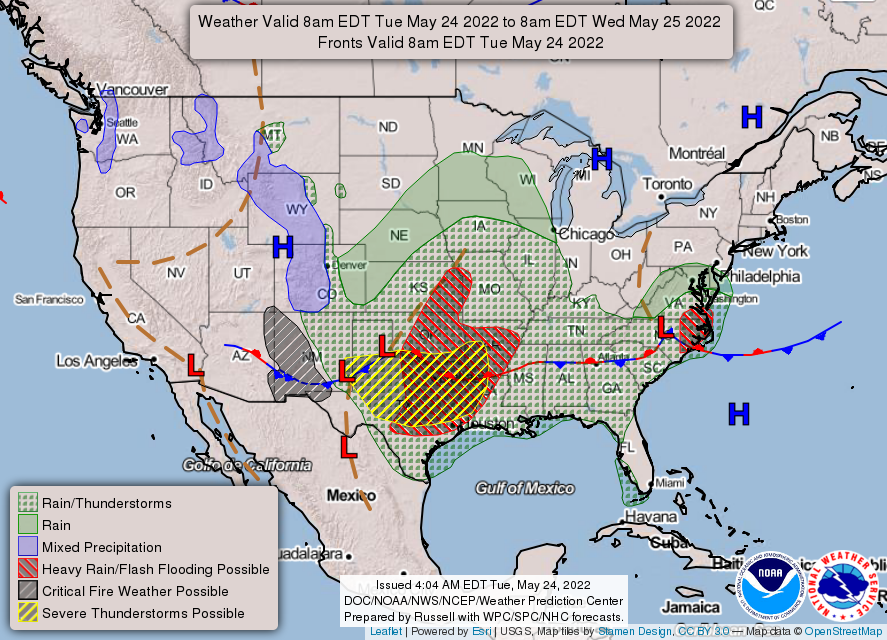
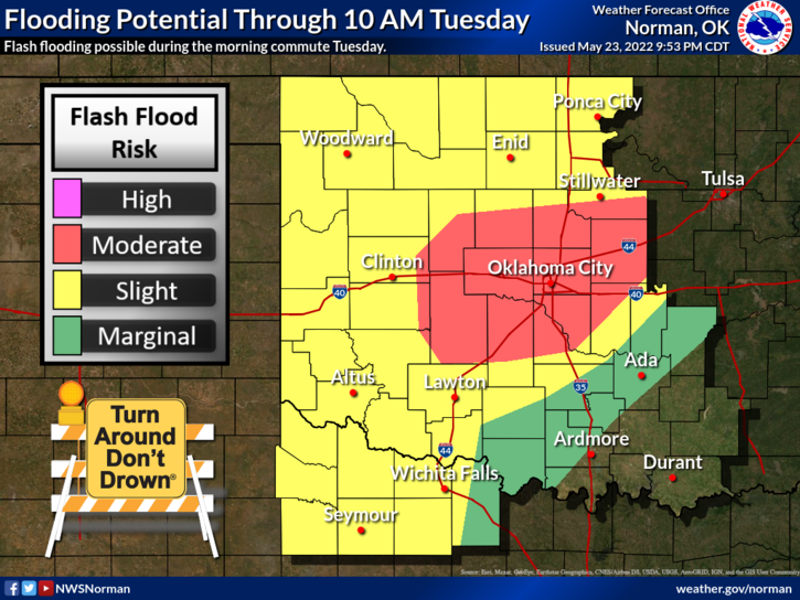
3- The higher risks for severe weather and flooding will occur south of us. See all graphics attached and read them carefully.
4- For now, HAVE A GOOD DAY!