0400L-TUESDAY OUTLOOK FROM GARFIELD COUNTY EMERGENCY MANAGEMENT-5/31/22
1- Here is your forecast from the NWS/NORMAN;
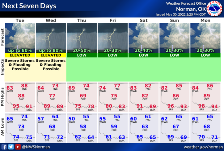
Today-Mostly sunny. Showers and thunderstorms likely this afternoon. Highs around 90. South winds 15 to 20 mph. Gusts up to 40 mph this morning. Chance of rain 60 percent.
Tonight-Showers, thunderstorms. Some thunderstorms may be severe in the evening. Lows in the mid-60s. Southeast winds 10 to 15 mph with gusts up to 25 mph, becoming northeast 5 to 10 mph after midnight. Chance of rain 80 percent.
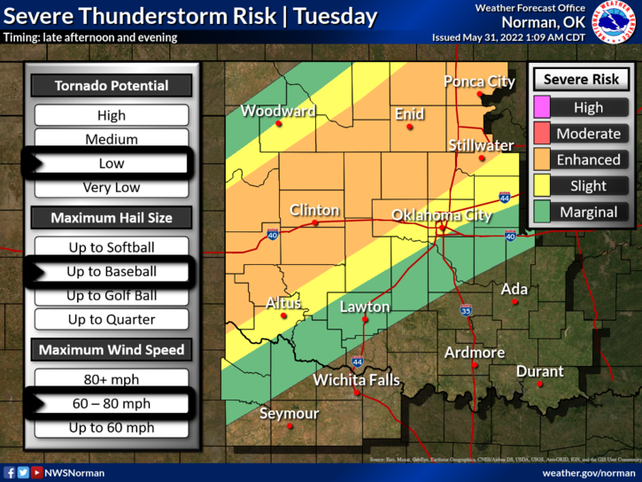
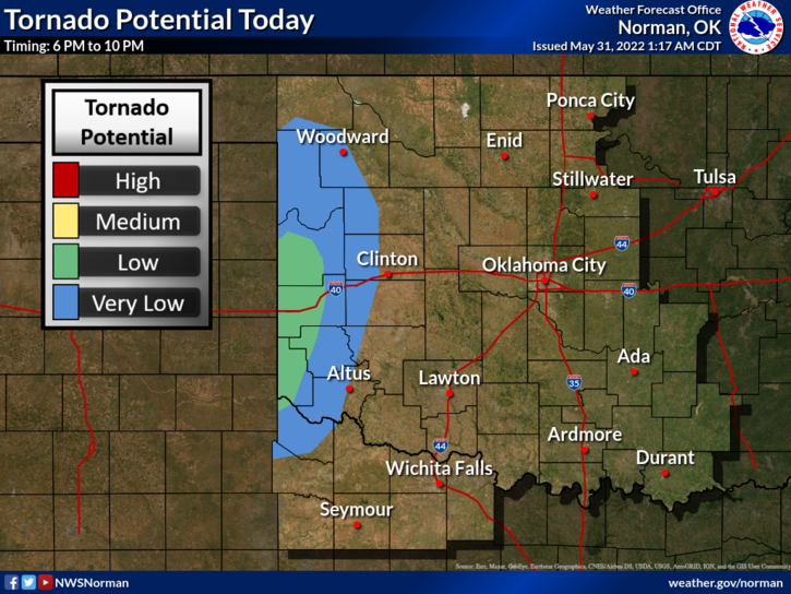
2- We are in an ENHANCED RISK for severe weather later this afternoon into the overnight hours. We are also in an AREAL FLOOD WATCH from 4pm today through June 2, at 0100 local time. A cold front is expected to push into the area and stall. The front will be the focal point for severe storms where all hazards could be possible. Large hail and damaging winds appear to be our bigger threats and the tornado risk is low. Tornadoes are more likely to occur farther west and southwest but are never out of the question. We’ll see what updated forecasts look like and send out that info over our GARFIELD COUNTY EM app.
3- Overall, we should be ok but be prepared for damaging winds and hail later today into the overnight hours. We will be under a SLIGHT RISK for storms tomorrow too.
Will update around mid-day or so. HAVE A GOOD DAY!