0410L-TUESDAY OUTLOOK FROM GARFIELD COUNTY EMERGENCY MANAGEMENT-5/7/19
GARFIELD COUNTY EM = PREPAREDNESS/KNOWLEDGE for peace of mind. It’s your choice.
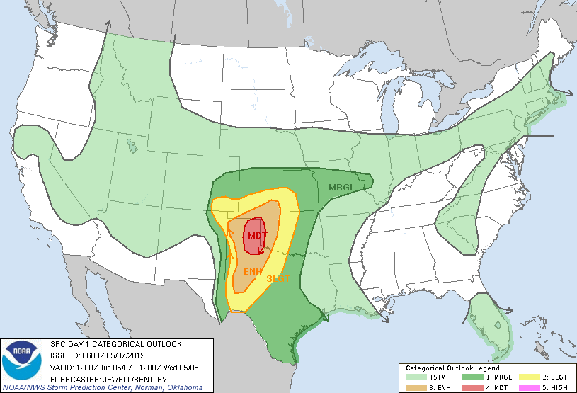
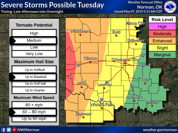
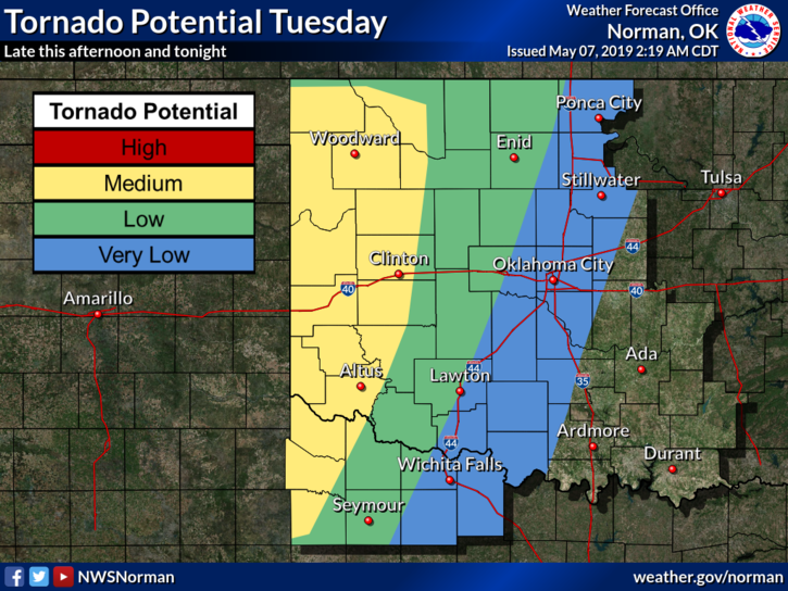
1- We are in a SLIGHT RISK for severe weather later today and tonight. Large hail, damaging winds, and isolated tornadic activity are possible around the region.
2- As stated in past posts when it comes to the graphics, they will change some and they have. See attached graphics. Again, no need to panic, storms will do what they want and move on. We just do cleanup if damage occurs. Just secure things around the house and at work and you’ll be ok. Make sure you have our app and listen to our LOCAL RADIO STATIONS.
3- We will conduct another storm siren test at 11 am this morning in Enid, dependent on the weather. We had a repeater issue yesterday and have replaced that repeater. If we can’t do the test today due to heavy cloud cover, you may hear some short siren noise as we work on known issues with a few of our sirens so don’t panic. This is why we test weekly now so we catch problems and fix them before we actually need them. DO NOT CALL 911 IF YOU HEAR SIRENS. You would be receiving alerts from US and there would be radio announcements concerning this too.
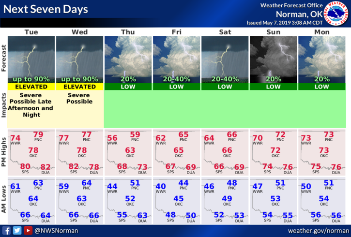
4- Here is your forecast from the NWS/NORMAN;
Tuesday=A chance of showers and thunderstorms before 7am, then a chance of showers and thunderstorms after 4pm. Mostly cloudy, with a high near 77. South wind 5 to 15 mph, with gusts as high as 21 mph. Chance of precipitation is 30%.
Tuesday Night-Showers and thunderstorms, mainly after 7pm. Some of the storms could be severe and produce heavy rainfall. Low around 63. South wind 10 to 15 mph, with gusts as high as 21 mph. Chance of precipitation is 80%. New rainfall amounts between 1 and 2 inches possible.
HAVE A GOOD DAY!!
MIKE