FROM GARFIELD COUNTY EMERGENCY MANAGEMENT-TUESDAY-11/14/17
Download our emergency app-GARFIELD COUNTY EM. You will need it this winter!!
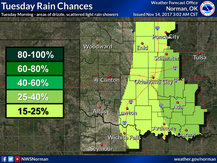
In looking at the forecast below, I really feel it should say, DRIZZLE ALL DAY AND HEAVIER DRIZZLE, WITH POSSIBLY SOME RAINFALL, FOR TONIGHT. Basically, another dreary day so try not to fall asleep at work. There is a good chance we’ll see that shiny thing in the sky tomorrow.
Tomorrow is our first annual DISASTER RESILIENCE SEMINAR. Everything has come together pretty well and it will be a very good learning tool for many folks that are attending. Believe it or not, we are already looking into what we may do next year and with the help of the questionnaires we are providing, I’m sure we’ll have some great suggestions. Those that attend but did not RSVP will be required to sign in. No big deal but I did have major email issues last week so don’t panic if your name wasn’t on the main list. For those that come, you’re in for “information overload.”
Here is your forecast from the NWS/NORMAN;
Tuesday-Patchy drizzle with isolated showers before 10am, then a slight chance of drizzle or sprinkles between 10am and 3pm. Patchy fog before 10am. Otherwise, cloudy, with a high near 64. South wind 9 to 14 mph, with gusts as high as 20 mph. Chance of precipitation is 20%.
Tuesday Night-Slight chance of drizzle with isolated showers after midnight. Mostly cloudy, with a low around 55. South southeast wind 5 to 14 mph becoming north after midnight. Winds could gust as high as 20 mph. Chance of precipitation is 20%.
HAVE A SUPER DAY!!
MIKE