0400L-TUESDAY OUTLOOK FROM GARFIELD COUNTY EMERGENCY MANAGEMENT-10/20/2020
1-Mostly cloudy and cool with some drizzle around the area today. We’ll see warmer temps on Wednesday and Thursday due to a warm front pushing up from the south before another cold front pushes in. There is an outside chance for thunderstorms later this evening and again on Thursday. Sunday may be our best bet for rain and a small chance for a winter mix. We’ll see how that mess turns out.
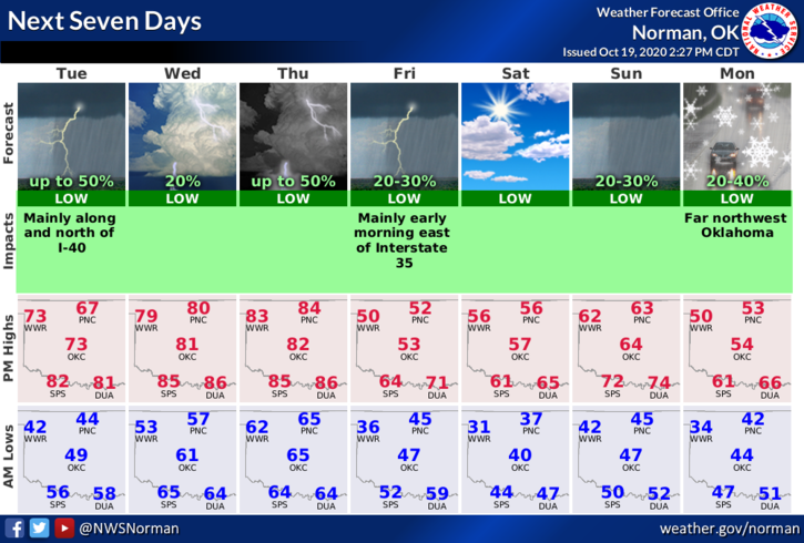
2- Here is your forecast from the NWS/NORMAN;
Tuesday- Patchy drizzle before 10am. Patchy fog before 7am. Otherwise, cloudy, with a high near 61. East wind 6 to 9 mph becoming south in the afternoon.
Tuesday Night- 50 percent chance of showers and thunderstorms. Cloudy, with a low around 55. East southeast wind 5 to 10 mph becoming northeast after midnight. New rainfall amounts between a quarter and half of an inch possible.
3- GARFIELD COUNTY EM is our notification app. If you live here in GARFIELD COUNTY and you don’t have this app, YOU ARE NOT PREPARED. Protect you and your family by downloading it, learning it, and knowing you have done what is needed to protect them.
HAVE A GOOD DAY!!
MIKE