0415L-WEDNESDAY OUTLOOK FROM GARFIELD COUNTY EMERGENCY MANAGEMENT-10/21/2020
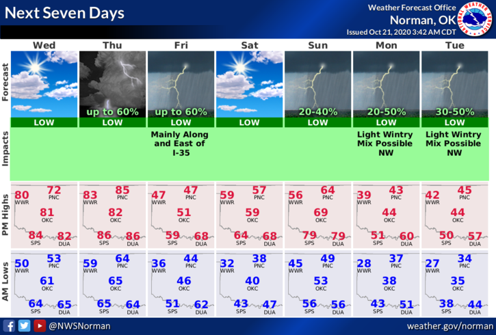
1- A few days around 80 degrees along with increasing winds appear to be the menu for today and Thursday. A front pushes through late Thursday night with a chance for thunderstorms. The weekend looks rather good but cooler. Another front is expected the first of the week and low temps Monday and especially Tuesday morning will bring our first hard freeze.
2- Tuesday morning having temps around 28 degrees or so could bring a wintry mix to our area. Right now, based on NWS Guidance we could POSSIBLY see some sleet or freezing rain. This could change but that is their thinking at this time. Between now and then, make sure you have your vehicles winterized and make sure you check on things around the house that may cause drafts or water issues once we get below freezing.
3- Heat is important but so is safety when using heat appliances. Be careful as using these heating devices could cause a fire if used incorrectly.
4- Here is your forecast from the NWS/NORMAN;
Today- Decreasing clouds. Warmer. Highs around 80. East winds around 10 mph shifting to the south in the afternoon.
Tonight- Clear. Lows in the lower 60s. South winds 10 to 15 mph.
Here is a link to the NWS cold weather information: https://www.weather.gov/safety/cold
Have a great day!
MIKE