0350L-TUESDAY OUTLOOK FROM GARFIELD COUNTY EMERGENCY MANAGEMENT-10/6/2020
1- A weak cold front will push through the region around mid-day. It is basically a windshift and colder temps are not expected but it will bring drier air into the area. Winds will be variable.
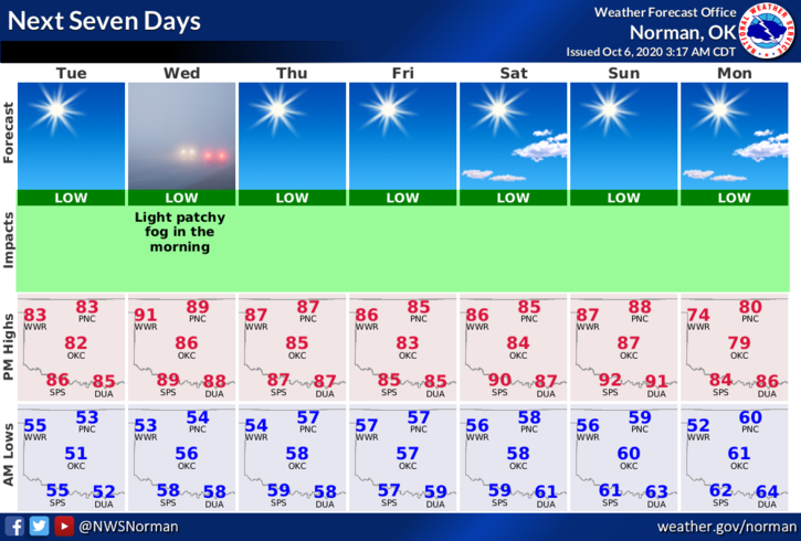
2- Temps this week will average in the mid to upper 80s except we may see low 90s on Wednesday. Overnight lows will average in the low to mid 50s. Rain has been taken out of the forecast for the foreseeable future.
3- A little info on our GARFIELD COUNTY EM notification app. Several people state that DISASTERS won’t happen here. They have in the past and they’ll happen again. You’re NOT PREPARED as you should be without this app. Don’t wait until the last minute to prepare! Download it today!!
4- Here is your forecast from the NWS/NORMAN;
Today- Sunny. Highs in the lower 80s. Southwest winds around 10 mph in the morning becoming light and variable.
Tonight- Clear. Lows in the lower 50s. Light and variable winds.
HAVE A GOOD DAY!!
MIKE