0315L-TUESDAY OUTLOOK FROM GARFIELD COUNTY EMERGENCY MANAGEMENT-9/19/23
* First of all, due to an equipment failure the WSR-88D weather radar at Kegelman Field is down. Hopefully techs can get it fixed before severe weather strikes later today.
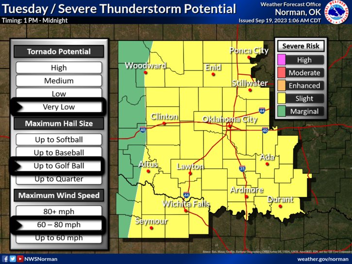
*We are in a SLIGHT RISK area for severe weather today. See the first Graphic. We will most likely have a few storms around the area this morning but these are not “expected” to be severe. The storms this afternoon are the main event so we’ll see what happens and how they track.
* Overall, we’ll be ok so here is your forecast from the NWS/NORMAN;
Tuesday- Partly sunny with a chance of showers and thunderstorms in the morning, then mostly cloudy with showers and thunderstorms likely in the afternoon. Some thunderstorms may be severe in the afternoon. Highs in the mid-80s. South winds 15 to 20 mph with gusts up to 30 mph. Chance of rain 60 percent.
Tuesday Night- Showers and thunderstorms likely, mainly in the evening. Some thunderstorms may be severe. Lows in the lower 60s. Southeast winds 10 to 15 mph with gusts up to 25 mph. Chance of rain 70 percent.
**Remember that incidents you EXPERIENCE in life gives you WISDOM for the future.
HAVE A GOOD DAY!