0340L-TUESDAY OUTLOOK FROM GARFIELD COUNTY EMERGENCY MANAGEMENT- 9/21/21
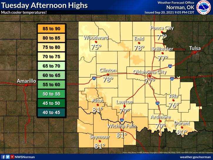
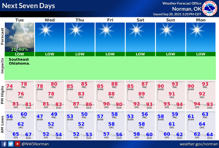
1-COOLER is the word for today and Wednesday with highs in the upper 70s. Colder for tonight with possibly upper 40s for low temps Wednesday morning. The rest of the week, we’ll see high temps average in the mid-80s and lows in the mid to upper 50s. We’ll probably see 90s again by next Sunday. Get outside and enjoy the cooler temps!!
2- Rain didn’t occur so the FIRE DANGER may be up there a little with stronger winds so be EXTREMELY CAREFUL OUT THERE. This is mainly for today. I would ask that folks refrain from controlled burning until Wednesday per forecast guidance when winds won’t be gusting so high.
3-Here is your forecast from the NWS/NORMAN;
Tuesday-10 percent chance of showers before 7am. Mostly cloudy, then gradually becoming sunny, with a high near 79. North wind 15 to 20 mph, with gusts as high as 29 mph.
Tuesday Night-Clear, with a low around 49. North wind 8 to 15 mph becoming light north northwest after midnight.
4- I am meeting with my APP FOLKS this morning in a video-conference to discuss app changes. They should be forthcoming very soon along with a new radar product. I think you all will like the change.
STAY SAFE!
MIKE