0410L-TUESDAY UPDATE FROM ENID/GARFIELD COUNTY EMERGENCY MANAGEMENT-9/4/18
PLEASE READ THE WHOLE POST.
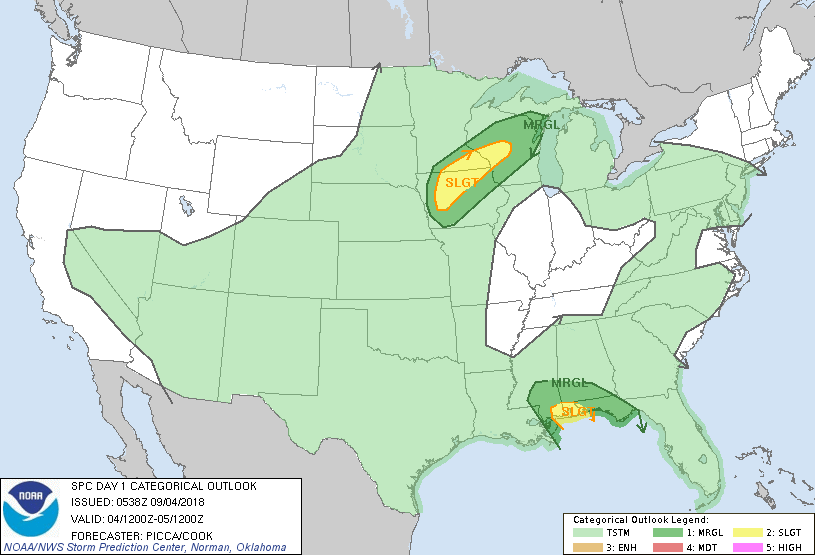
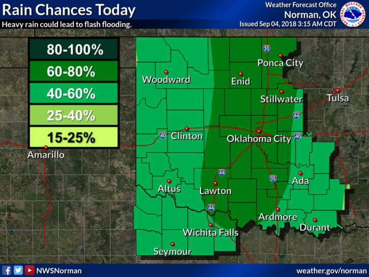
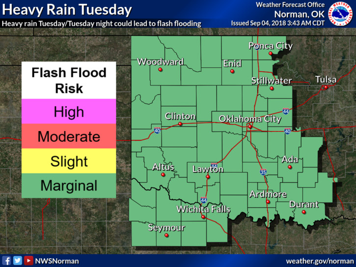
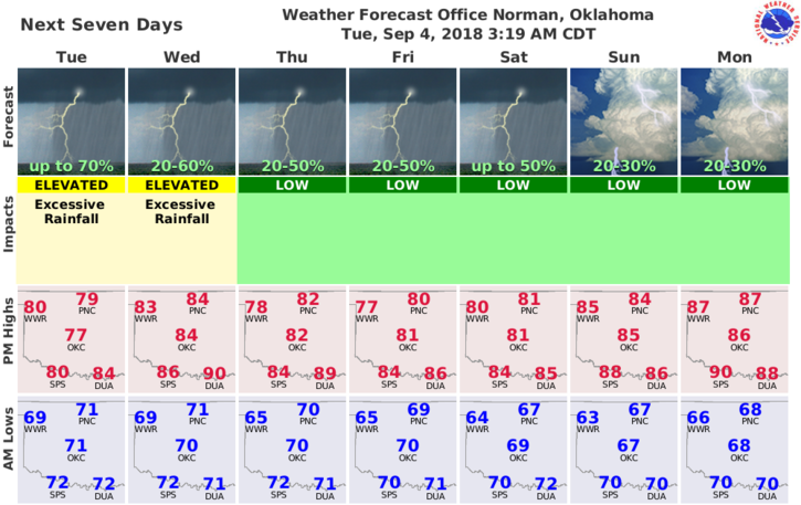
1- RAIN is the main story today and for this week. We can expect to receive several inches of rainfall during this week. It won’t rain all the time, all week, BUT when it rains, it will pour. The storm track for tropical storm Gordon has moved a little so don’t believe all the storm track stuff you see on social media unless that info is DIRECTLY from the NATIONAL HURRICANE CENTER.
2- We have received .75 of an inch of rainfall so far. Please send me your totals THROUGH OUR GARFIELD COUNTY EM app DAMAGE REPORT ICON. If you don’t have it, download it as posting totals on social media isn’t an accurate way to get info to me. You may also email your totals to me to mike@gcem.org or mhonigsberg@enid.org
3- My reasoning for the statement on #2 above, I don’t live on social media so if you send comments or questions, just follow the info above. I will answer all damage reports if required.
4- Enjoy the rain this week and especially the cooler temps. Here is your forecast from the NWS/NORMAN;
Today-Mostly cloudy. Showers likely and isolated thunderstorms in the morning, then thunderstorms likely in the afternoon. Highs in the upper 70s. South winds 10 to 15 mph. Chance of precipitation 70 percent.
Tonight-Mostly cloudy with a chance of showers and isolated thunderstorms. Lows around 70. Southeast winds around 10 mph in the evening becoming light and variable. Chance of precipitation 30 percent.
FINAL COMMENT- The weather this week is not expected to be severe. If that becomes an issue, I will send advisories over the GARFIELD COUNTY EM app.
HAVE A SUPER DAY!!
MIKE