0426L-WEDNESDAY UPDATE FROM ENID/GARFIELD COUNTY EMERGENCY MANAGEMENT-4/11/18
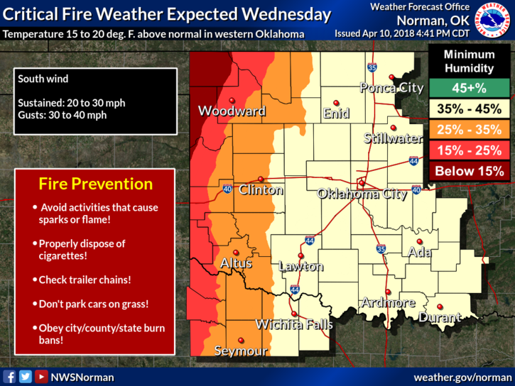
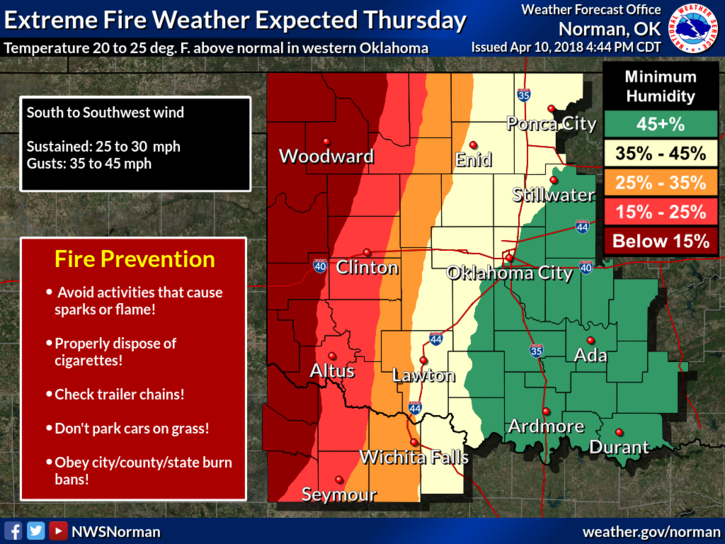
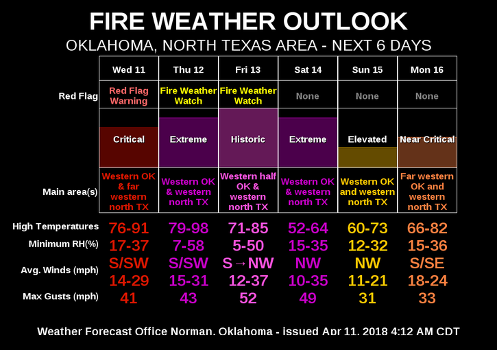
1- As stated last night, the FIRE DANGER will be the big item for the next several days. There are watches and warnings out already so if traveling, keep an eye out. We are in an ELEVATED RISK TODAY. This might change so just stay aware.
2-Temperatures will be in the “80s” today through Friday and then on Saturday we’ll drop back into the 50’s for highs and into the upper 20’s for lows Saturday night into Sunday morning.
3- PERSONAL COMMENT HERE; If we are going to be getting this cold after getting so hot, we may as well at least be getting some snow. At least it would be wet stuff falling from the sky. That’s not likely right now but neither is rain. We can only hope!!
4- Here is your forecast from the NWS/NORMAN;
Today-Mostly sunny, with a high near 81. Windy, south southwest wind 15 to 25 mph, with gusts as high as 36 mph.
Tonight-Partly cloudy, with a low around 62. South wind 20 to 25 mph, with gusts as high as 31 mph.
HAVE A GREAT DAY AND REPORT ANY SMOKE OR FIRE TO 911.
MIKE