0330L-WEDNESDAY OUTLOOK FROM GARFIELD COUNTY EMERGENCY MANAGEMENT 4/19/23
*See attached graphics.
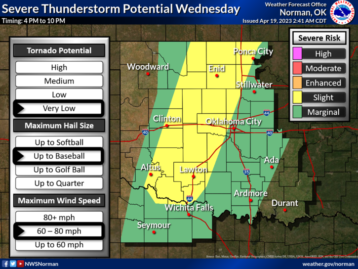
* SLIGHT RISK for severe weather later today. In our area, along the dryline, if updrafts can overcome the capping inversion, we could see supercells form very quickly. All hazards in this situation are possible. There is a strong possibility that we may not see anything. Kansas and locations up north will have that higher threat, in the event you are traveling that way, STAY AWARE OF CONDITIONS.
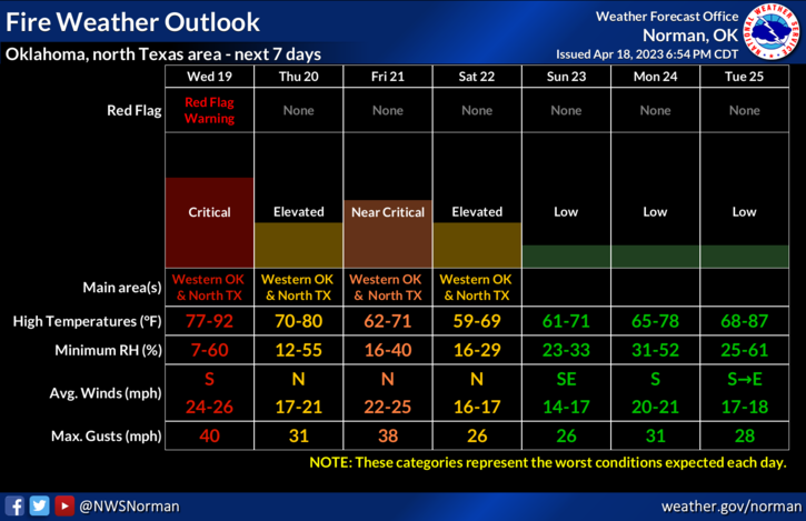
*Our higher risk today is FIRE WEATHER. RED FLAG WARNING is in effect just to our west so keep in mind that even though we aren’t painted into that warning, our THREAT LEVEL is CRITICAL. NO CONTROLLED BURNING AS WINDS will be sustained at 20-25 mph and we could see gusts upwards of 40-45 mph.
Overall, we’ll be ok so here is your forecast from the NWS/NORMAN:
Today- Partly sunny. A slight chance of showers and thunderstorms this afternoon. Breezy with highs in the upper 80s. South winds 15 to 25 mph with gusts up to 40 mph. Chance of rain 20 percent.
Tonight- Partly cloudy with a slight chance of showers and thunderstorms in the evening, then mostly cloudy with a chance of showers and thunderstorms after midnight. Windy with lows around 50. South winds 20 to 30 mph with gusts up to 40 mph. Chance of rain 50 percent.
HAVE A GOOD DAY!