0315L-WEDNESDAY OUTLOOK FROM GARFIELD COUNTY EMERGENCY MANAGEMENT-4/7/21
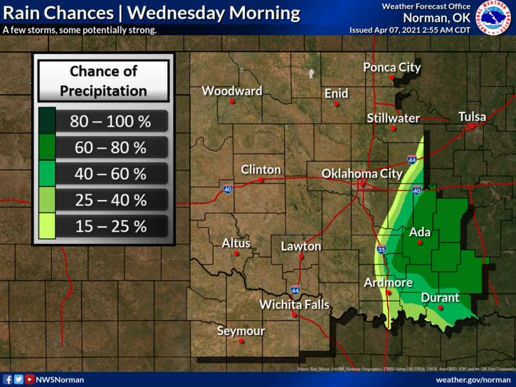
1- A little noise overnight but minimal rainfall. Winds have shifted from the southwest to the northwest and storms are moving away. Per forecast guidance, there is a very low chance for some rain later this afternoon before the upper low moves out of the area. We’ll see what happens.
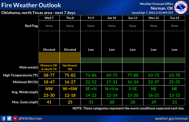
2- This front will take the majority of the moisture we have enjoyed with it so the fire danger will increase as dryer air moves in. Lower humidity and dew point temps along with the wind will help the fire danger. Keep a vigilant eye out there and remember that smoke will tend to stay low to the ground with strong winds. Call 911 if you see smoke and or fire so the proper response can be sent. WE RECOMMEND THAT NO CONTROLLED BURNING BE DONE AS IT’S DIFFICULT TO CONTROL FIRE IN THESE WINDS. THANK YOU!!
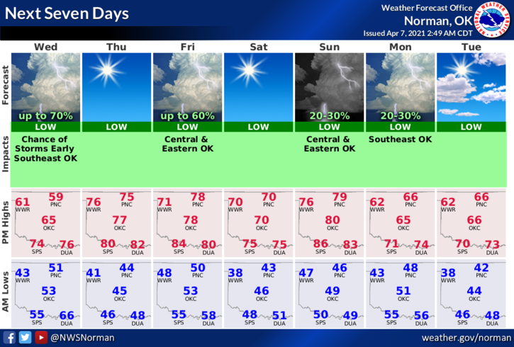
3-Overall, we’ll be ok and we should see some sunshine maybe today but for sure on Thursday. Here is your forecast from the NWS/NORMAN;
Today-Partly cloudy until late afternoon, then mostly cloudy with a slight chance of rain showers late in the afternoon. Cooler. Highs in the lower 60s. Northwest winds 15 to 25 mph. Chance of showers 20 percent.
Tonight-Partly cloudy. Lows in the lower 40s. West winds 10 to 20 mph.
Be sure to download our GARFIELD COUNTY EM app. It just might save your life.
HAVE A GOOD DAY!
MIKE