0355L-TUESDAY OUTLOOK FROM GARFIELD COUNTY EMERGENCY MANAGEMENT-4/6/21
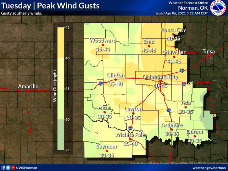
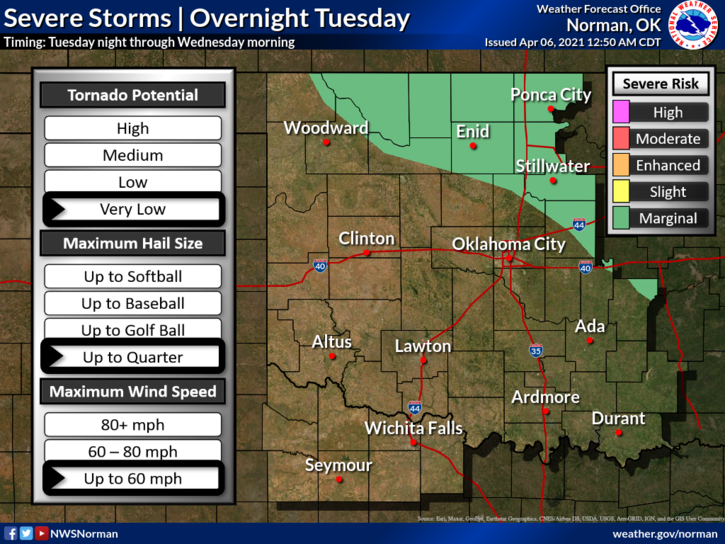
1- We are in a Marginal Risk for severe weather later tonight. If storms occur, hail and winds will be the main risks. Timing will be overnight tonight. We have a storm system moving across the plains and as it passes, it will pull a cold front through the area. Today and tonight as this mess comes together, the winds may hit advisory levels with gusts into the 40mph range. The NWS has issued a wind advisory as of 0346 this morning. It’s in effect from 11 am until 8 pm this evening.
2- Make sure you have our GARFIELD COUNTY EM app so you stay up with the latest from the NWS and GCEM. Overall, we’ll be ok so stay alert and we’ll advise as needed.
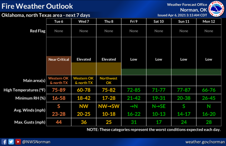
3- The FIRE DANGER will be ELEVATED through Thursday so keep a sharp eye out there. You all know what to do and we thank you.
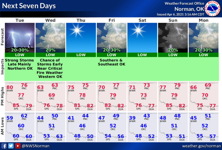
4- Here is your forecast from the NWS/NORMAN;
Today-Decreasing clouds. Highs in the upper 70s. South winds 15 to 25 mph. Gusts up to 45 mph in the afternoon.
Tonight-Partly cloudy. A slight chance of thunderstorms after midnight. Cooler. Lows in the upper 40s. South winds 20 to 25 mph shifting to the west 15 to 20 mph after midnight. Chance of thunderstorms 20 percent.
HAVE A GOOD DAY!
MIKE