0355L-WEDNESDAY OUTLOOK FROM GARFIELD COUNTY EMERGENCY MGMT-8/12/2020
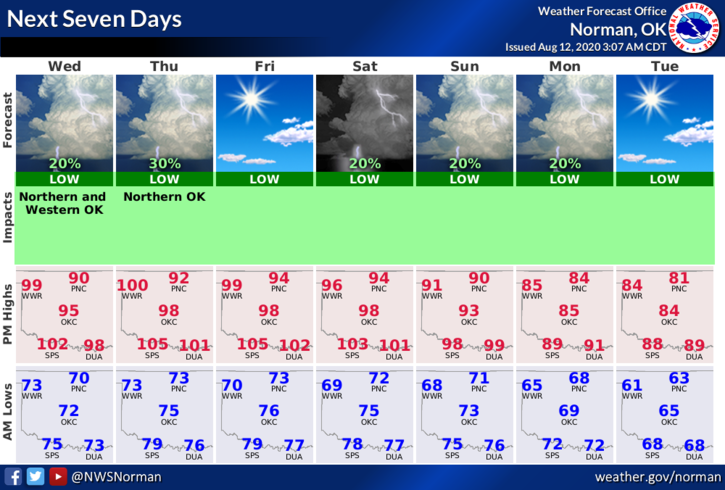
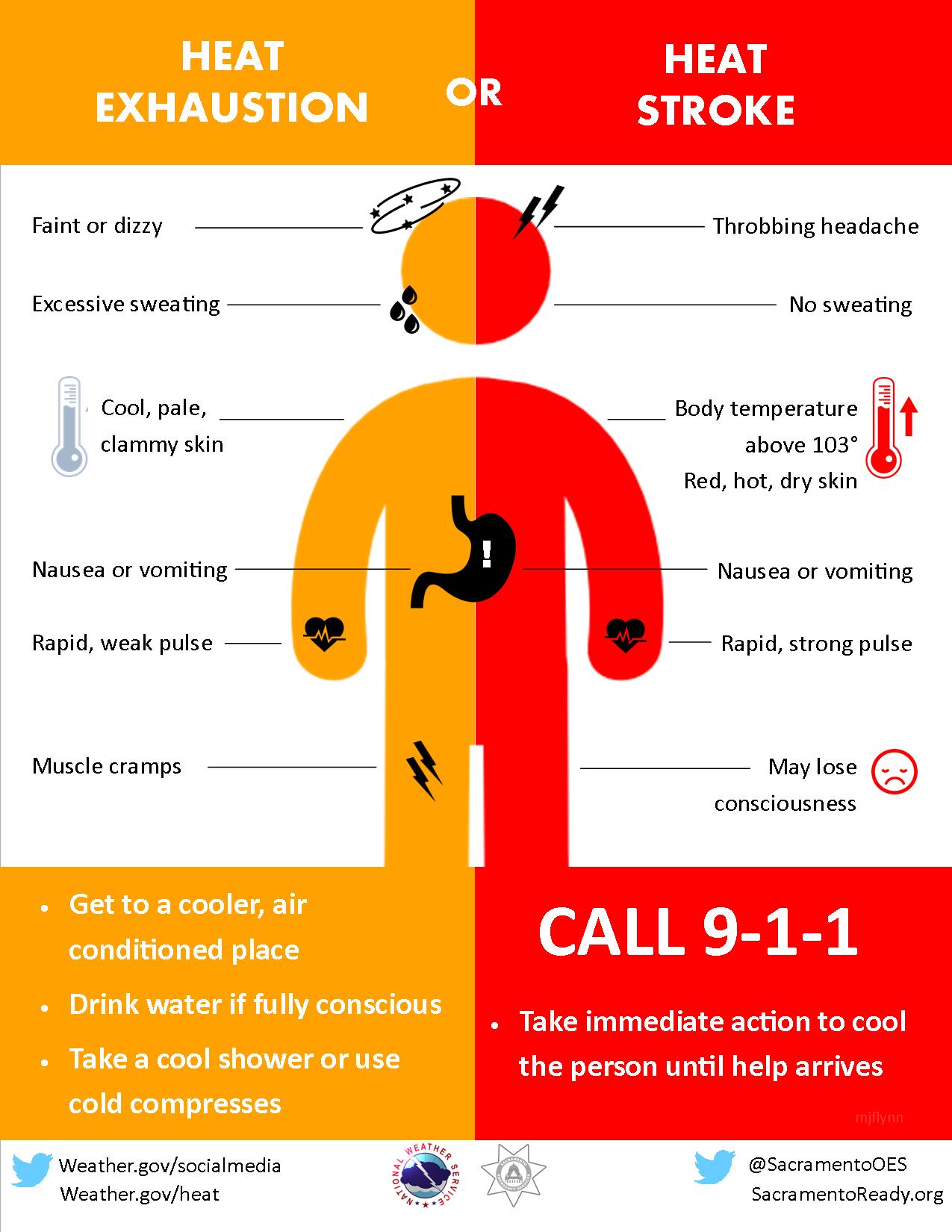
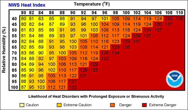
1- HEAT ADVISORY IN EFFECT FROM 1PM TODAY THROUGH 9PM THURSDAY EVENING. Heat Index values to 109 are possible. EXTREME CAUTION IS ADVISED for anyone working outdoors. Be sure and hydrate properly.
2- Chance for thunderstorms this morning then hot and muggy this afternoon. The heat and heat index will be the main issues for the next several days with the possibility for rain so muggy conditions will continue. We are also near a MARGINAL Risk area for thunderstorms but in a GENERAL RISK AREA so we’ll keep an eye out for those.
3- Here is your forecast from the NWS/NORMAN;
Today- Partly cloudy with a 20 percent chance of thunderstorms early in the morning. Highs in the low to mid-90s. Southeast winds 10 to 15 mph gusting to 20 mph. Heat Index values to 104 possible.
Tonight- Mostly clear. Lows in the lower 70s with southeast winds 10 to 15 mph.
HAVE A GOOD DAY!!
MIKE