0335L-WEDNESDAY OUTLOOK FROM GARFIELD COUNTY EMERGENCY MANAGEMENT-8/30/23
*Today’s post can be found under GCEM Blog on the GARFIELD COUNTY EM app. It can also be found on the front page of our website at https://gcem.org
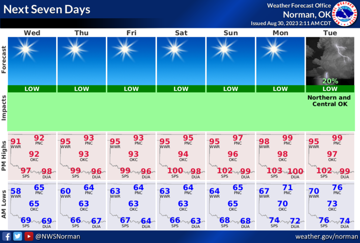
* Temps will continue to slowly climb as that pesky upper low makes an attempt to move back into the area by this weekend. Winds will remain lite from the NNE and will become southeasterly late tonight into Thursday. Those winds will increase by Friday afternoon, if not earlier and we’ll see higher temps on Friday thru the weekend.
*I have been talking about the fire danger increasing and the drought conditions lately. I feel our conditions here in the county are a little worse than the drought monitor folks think. Someone dragging a chain or pipe along Breckinridge road started several ditch fires yesterday that could have been tragic for a corn farmer and it burned into some soybeans in a field too. If you are hauling anything, please make sure that the load is secure before leaving so this doesn’t happen anymore. This isn’t the first time this has happened but someone’s livelihood could be severely damaged. By the way, Enid, Breckinridge, Fairmont, and Pioneer Fire responded to those fires.
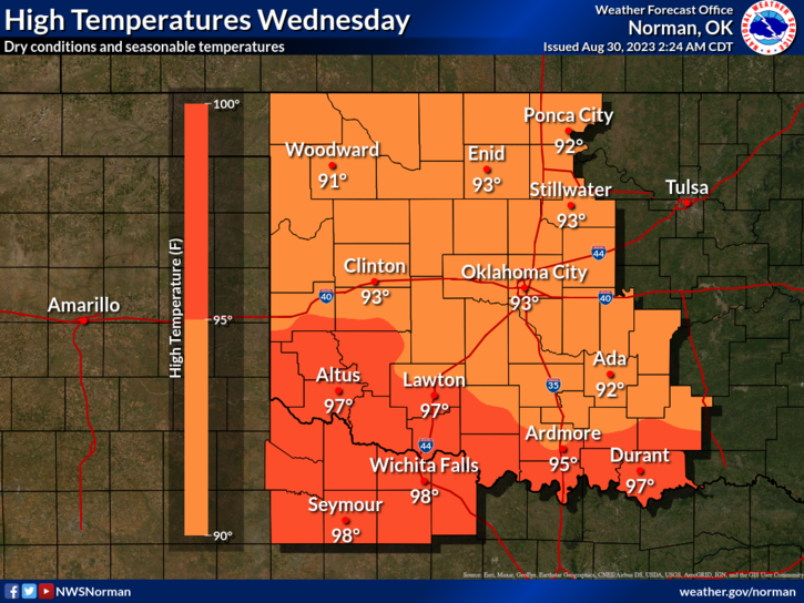
*Overall, we’ll be ok so here is your forecast from the NWS/NORMAN;
Today- Sunny. Highs in the lower 90s. Northeast winds 5 to 10 mph.
Tonight- Clear. Lows in the lower 60s. East winds around 5 mph.
FINALLY, September is PREPAREDNESS MONTH so I will be posting some info on what steps you SHOULD take to get ready for winter, being prepared for severe weather, what to do in the event of a natural or man-made disaster.
HAVE A GOOD DAY!