0355L-WEDNESDAY OUTLOOK FROM GARFIELD COUNTY EMERGENCY MANAGEMENT-2/10/21
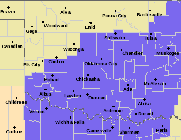
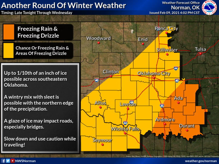
1- WINTER WEATHER ADVISORY UNTIL 6PM TONIGHT JUST TO OUR SOUTH FOR THE S.E. 2/3RDS OF OKLAHOMA. FREEZING RAIN/DRIZZLE ARE THE MAIN THREATS.
2- Traveling ANYWHERE is NOT advised. Even here in Enid, some roads are very treacherous. There is no reason to be in a major hurry as that will just cause an accident. Stay at home if at all possible and if you have to be out, be extremely careful.
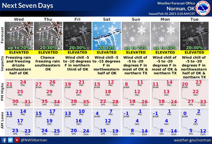
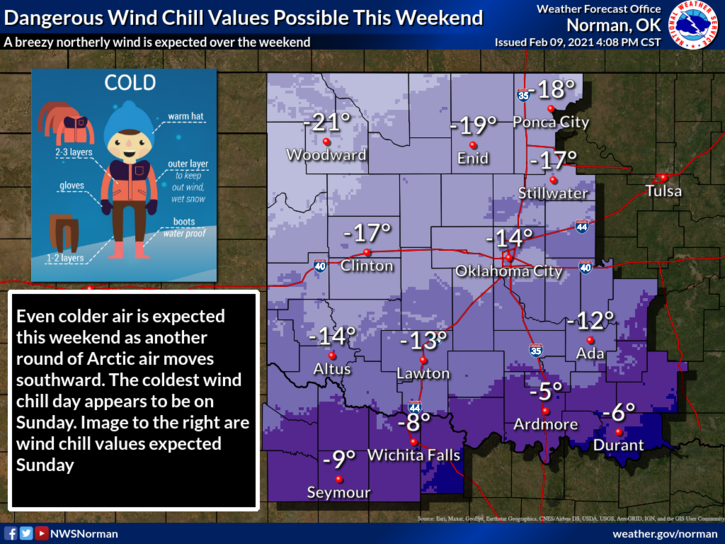
3- We will be dealing with the cold for at least another week but the most dangerous temps will occur over the weekend as a reinforcing shot of arctic air pushes in this weekend. With that additional cold air comes the winds. Wind chill temps on Sunday and Monday could be as low as minus 19 to minus 25. Basically, BITTER COLD.
4- Next Monday through Wednesday, we can expect possibly 2 systems through here that may bring us a substantial amount of snow and yes there could be some more ice involved too. Enough bad news for now, here is your forecast from the NWS/NORMAN;
Today-Cloudy. Patchy light freezing drizzle in the morning. Highs in the mid-20s. North winds 10 to 15 mph.
Tonight-Cloudy. Lows around 17. North winds 10 to 15 mph.
Finally, PLEASE BE CAREFUL and stay safe.
MIKE