0415L-THURSDAY OUTLOOK FROM GARFIELD COUNTY EMERGENCY MANAGEMENT-2/11/21
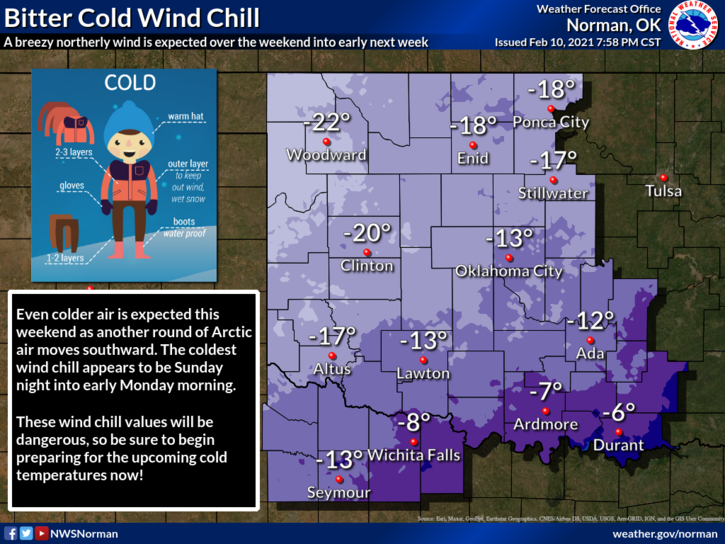
1- BITTER COLD temps will continue so if you have to get out, be careful. Don’t get too overconfident driving either. I have seen a few of these overachievers end up in the ditch. There will always be those few!!
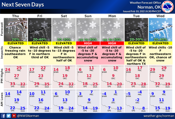
2- Weather-wise, DO NOT PANIC over ratings needed TV station super high snowfall amounts. Especially those that say 100%. Realistically, 5 to 10 inches likely right now based on NATIONAL WEATHER SERVICE INFORMATION, they aren’t ratings based. THICKNESS of the cold air is the key factor as storm systems pass over the area. YES, it’s going to snow BUT if cold air thickness lessens, we could possibly see freezing drizzle or rain. There are many factors involved. The Sunday/Monday timeframe will allow us to see some snowfall and then as systems move through, that thickness will be monitored for additional precipitation.
3- Don’t let the media drive your decision making like they have before. Research this for yourself. Read the discussions and understand what you are reading. Here is your forecast from the NWS/NORMAN;
Today-Mostly cloudy with a high near 23. Wind chill values as low as -3. North wind 10 to 15mph.
Tonight-Mostly cloudy with a low around 12. Wind chill values as low as -1. North northeast wind 10 to 15 mph, with gusts as high as 20 mph.
STAY WARM, RESEARCH DATA FOR YOURSELF, and HAVE A GOOD DAY!!
MIKE