0410L-WEDNESDAY OUTLOOK AND INFO FROM GARFIELD COUNTY EMERGENCY MGMT-7/10/19
GARFIELD COUNTY EM- This is our countywide app. If you don’t have it, you’re NOT prepared.
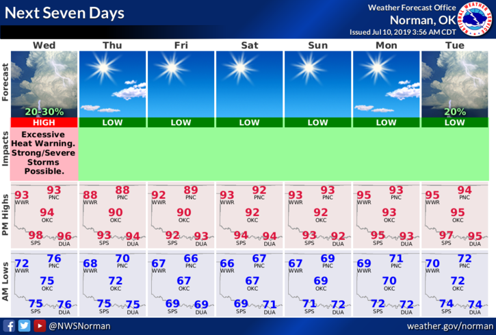
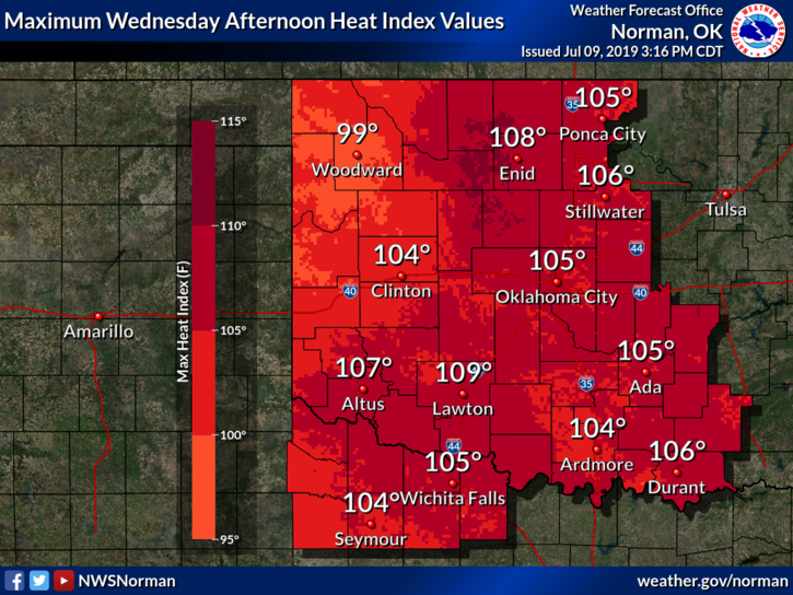
1- HEAT ADVISORY EXTENDED UNTIL 8 PM THIS EVENING. Heat index values up to possibly 110 due to temps in the upper 90’s and dew point temps in the mid 70’s. This can become a dangerous issue. An EXCESSIVE HEAT WARNING, HEAT INDEX VALUES FROM 110-115, is in effect for the same time period. GARFIELD COUNTY IS NOT INCLUDED AS THE FRONT MAY MAKE IT TO US BEFORE WE REACH THOSE CRITERIA. Call 911 for heat related illness.
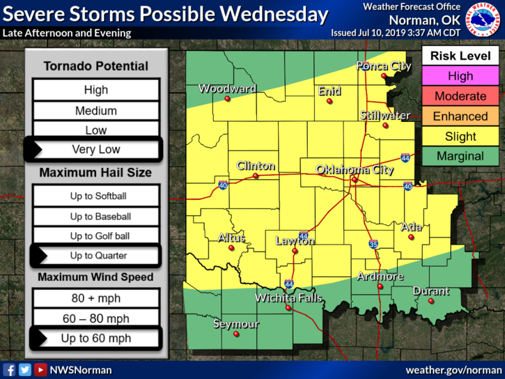
2- We are in a SLIGHT RISK for severe weather this afternoon into the evening hours. A cold front is forecast to affect the area this afternoon and with the heat, the humidity and the boundary, it might get interesting. Wind and hail would be our threats. We’ll see what happens.
3- Here is your forecast from the NWS/NORMAN;
Wednesday-20 percent chance of showers and thunderstorms after 1pm. Mostly sunny with a high near 96. Heat index values as high as 108. Light and variable wind becoming east northeast around 6 mph in the afternoon.
Wednesday Night-Partly cloudy with a low around 71. Northeast wind around 10 mph becoming calm.
HAVE A GOOD DAY!!
MIKE