0350L-WEDNESDAY UPDATE FROM ENID/GARFIELD COUNTY EMERGENCY MANAGEMENT-7/11/18
1- The WSR-88D Weather Radar known as the Vance Radar is fully operational. Techs worked very hard to make this happen. We now have lower level surveillance back for weather operations.
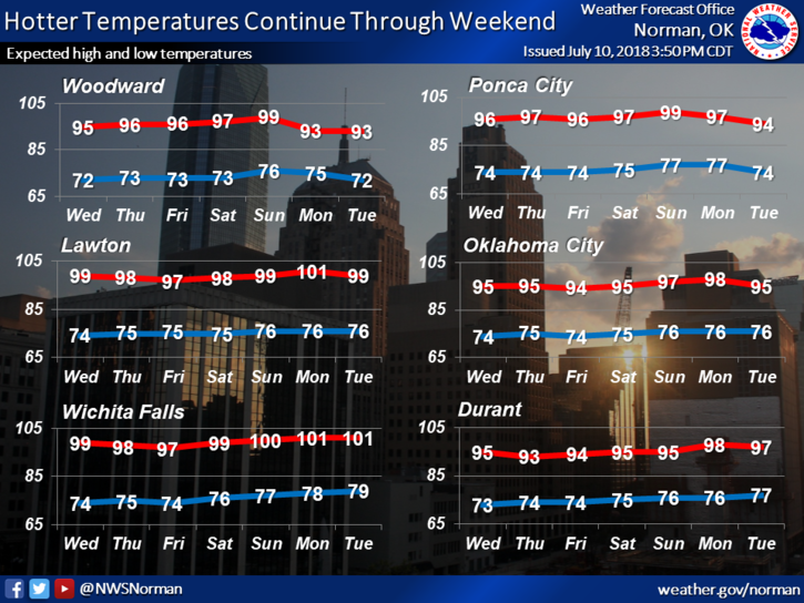
2-The heat will continue to be a major factor and I know I have been preaching HEAT SAFETY for quite some time. I will continue this until we cool off then I will preach cold weather safety. You just can’t get away from it, can you? Just pay close attention to what your body is telling you if you are working outside and the most important thing here is STAY HYDRATED. Don’t forget your pets too.
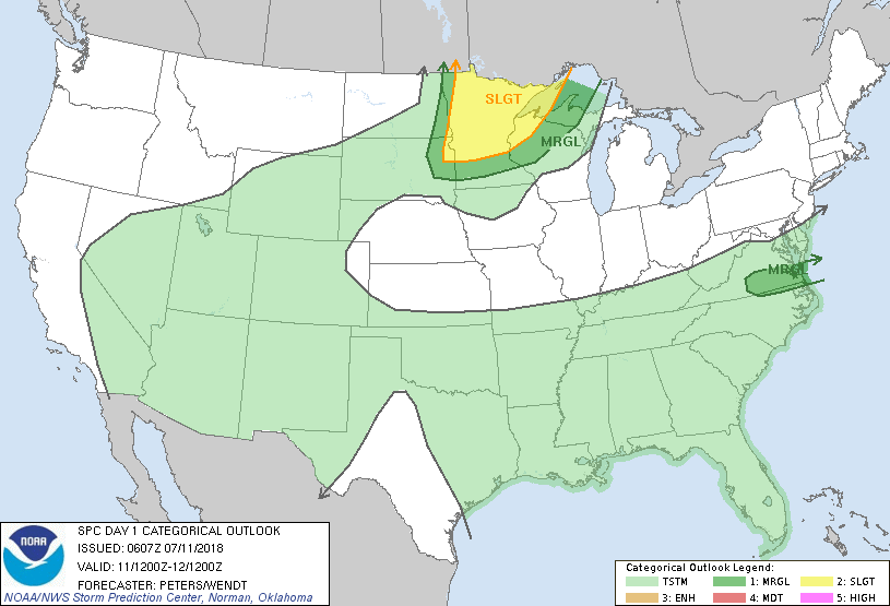
3-We are in a GENERAL RISK for thunderstorms meaning they may happen, they may not. Under our present conditions, we should be mostly dry around the area. Always remember that this could change. Just stay weather aware. The main threat as we have already experienced this year would be winds from collapsing storms. We’ll see what happens.
4-We will be testing our Mass Notification systems today between 1130 and 1300 local time so expect our GARFIELD COUNTY EM app to alert you. Hopefully Nixle works too.
5- Here is your forecast from the NWS/NORMAN;
Wednesday-Mostly sunny, with a high near 96. Heat index values as high as 99. South southeast wind 5 to 10 mph.
Wednesday Night-Mostly clear, with a low around 75. Southeast wind 7 to 10 mph.
HAVE A SUPER DAY!!
MIKE