0330L-WEDNESDAY OUTLOOK & INFO FROM GARFIELD COUNTY EMERGENCY MANAGEMENT-7/31/19
1- HEAT ADVISORY in effect from noon today until 8pm this evening. You all know what this means so be careful out there.
2- The FIRE DANGER is slowly creeping up so be careful utilizing anything related to fire. If you mess up, call 911.
3- “Slight” chance for rain late Friday into Saturday but I wouldn’t hold my breath on this right now.
4-Here is another MYTH/FACT concerning lightning. I’ll have different ones in the future.
MYTH: If it’s not raining or there aren’t clouds overhead, you’re safe from lightning.
FACT: Lightning often strikes more than three miles from the center of the thunderstorm, far outside the rain or thunderstorm cloud. “Bolts from the blue” can strike 10-15 miles from the thunderstorm.
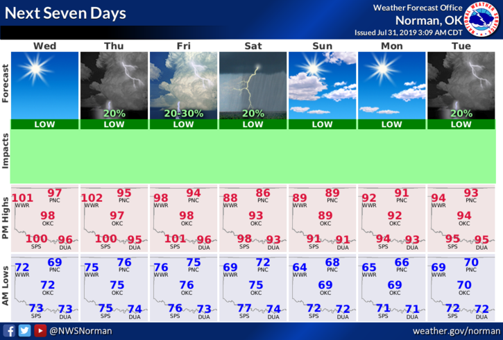
5- Here is your forecast from the NWS/NORMAN;
Wednesday-Sunny and hot with a high near 100. Heat index values as high as 104. South winds 5 to 15 mph gusting as high as 25 mph.
Wednesday Night-Overnight low around 75. South winds 10 to 15 mph gusting as high as 25 mph.
HAVE A GOOD DAY!!
MIKE