0425L-WEDNESDAY UPDATE FROM ENID/GARFIELD COUNTY EMERGENCY MANAGEMENT-6/6/18
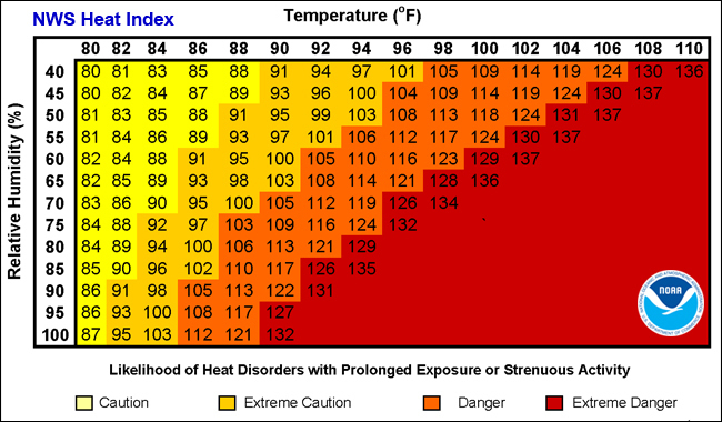
1- HOT TEMPS WILL BE THE ISSUE FOR THE REST OF THE WEEK ALONG WITH THE HEAT INDEX. YOU WILL FIND A HEAT INDEX GRAPH BELOW.
2- With HEAT as the main issue, just remember to pace yourself out there and stay hydrated.
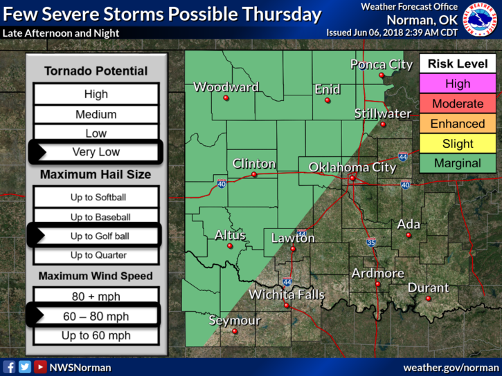
3- There will be a few opportunities for thunderstorms this week with damaging winds as the main threat. We’ll see how that works out. Otherwise, just hot and windy at times.
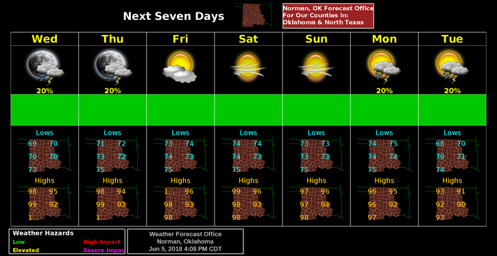
4- Here is your forecast from the NWS/NORMAN;
Wednesday-Sunny, with a high near 96. Heat index values as high as 101. South southeast wind 10 to 15 mph, with gusts as high as 25 mph.
Wednesday Night-20 percent chance of showers and thunderstorms before 1am. Increasing clouds, with a low around 72. South southeast wind 10 to 15 mph, with gusts as high as 25 mph.
HAVE A GREAT DAY!!
MIKE