0400L-WEDNESDAY OUTLOOK FROM GARFIELD COUNTY EMERGENCY MANAGEMENT-3/13/19
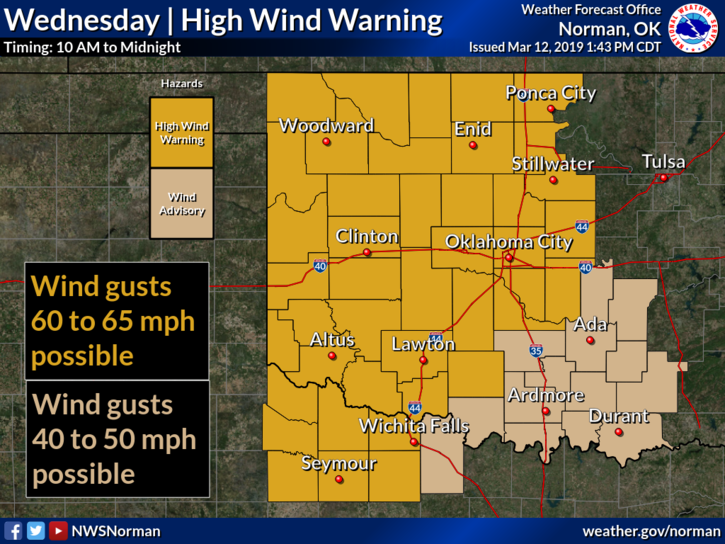
1- HIGH WIND WARNING IN EFFECT FROM 10 AM UNTIL THURSDAY AT 1 AM. WINDS 30-50 MPH GUSTING TO 60+ ARE POSSIBLE. EXTREME CAUTION IS ADVISED.
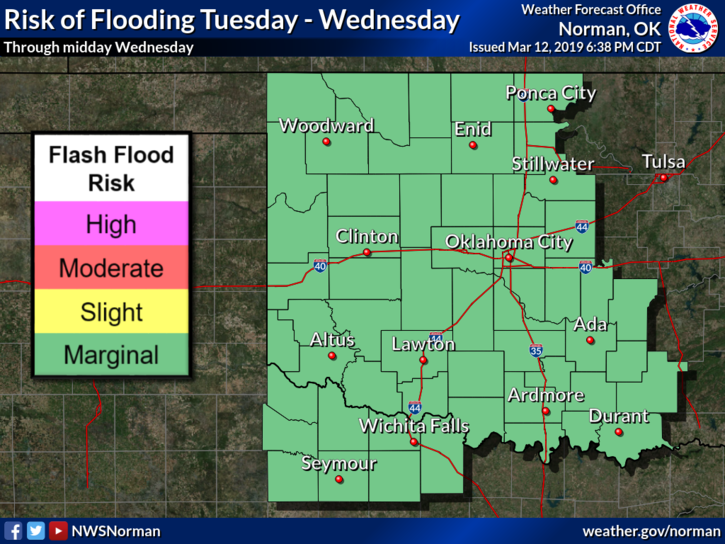
2- Some wanted rain; we have received around 1.5 inches of rainfall and more is coming. I would appreciate your reports preferably through our GARFIELD COUNTY EM app. Send them under Damage Reports. Fill in the info, INCLUDE YOUR NAME & address and send it. Also, if you are having FLOODING issues, send that too and I will send that report to the proper department. No name and address, no report. Thank you all.
3- Other than periods of torrential rainfall headed our direction, the winds will pick up dramatically as the front pushes through so be careful out there later in the day. Winds will be a bit gusty on Thursday but not as high as today.
4- Here is your forecast from the NWS/NORMAN;
Today-Rain showers and isolated heavy thunderstorms early in the morning. Mostly sunny in the afternoon, windy & warmer. Highs in the lower 70s. South winds 20 to 30 mph with gusts to around 45 mph increasing to 35 to 40 mph with gusts to around 60 mph in the afternoon.
Tonight-Partly cloudy. Very windy. Colder. Lows around 40. Southwest winds 30 to 40 mph with gusts to around 55 mph becoming west 15 to 20 mph after midnight.
I’ll advise as needed.
MIKE