0320L-WEDNESDAY OUTLOOK FROM GARFIELD COUNTY EMERGENCY MANAGEMENT 03/20/24
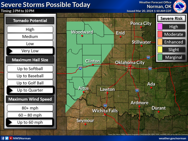
*There is a MARGINAL RISK for severe weather mainly to our west later today into the evening and overnight hours. This risk could filter into our area depending on the storm track later today and tonight. Quarter size hail and winds to 60 mph are possible. See graphic. The higher chance for rainfall for us will be overnight into Thursday. We’ll have to wait and see how the system develops and tracks.
* Moisture will be slow to filter in so rainfall amounts may be light. Hopefully we do see a little rainfall from this. Overall, we’ll be ok so here is your forecast from the NWS/NORMAN;
Today- Sunny. Highs in the mid-70s. Southwest winds around 5 mph, becoming southeast this afternoon.
Tonight- Mostly cloudy with a chance of showers and thunderstorms. Lows in the upper 40s. East winds 5 to 10 mph. Chance of rain 50 percent.
*I will have some storm season information starting tomorrow morning that all of you should at least read. Preparedness is different for everyone due to each ones specific needs so just understand that there is not a perfect universal list to go by for the preparedness process. More on this as we move into the heart of storm season. Just remember that there’s no need to panic, just educate yourselves and we’ll be ok.
HAVE A GOOD DAY!