0325L-WEDNESDAY OUTLOOK FROM GARFIELD COUNTY EMERGENCY MANAGEMENT-5/18/22
1- PREPAREDNESS starts with our GARFIELD COUNTY EM app. Don’t wait until it’s too late!
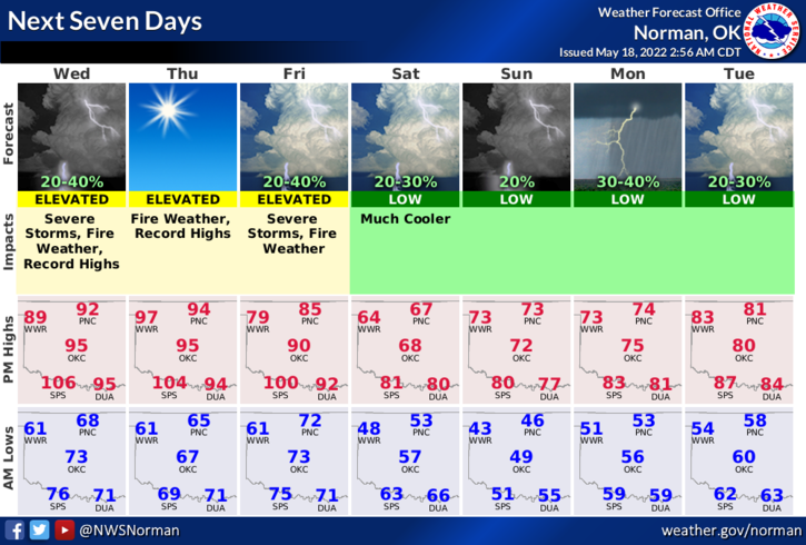
2- Here is your countywide forecast from the NWS/NORMAN;
Today-Sunny. Highs in the lower 90s. Northeast winds 10-15 mph.
Tonight-Mostly clear, then becoming partly cloudy. Lows in the mid-60s. NE winds 10-15 mph.
3- The heat is still on until late Friday and then a front will push in lowering our temps for highs into the 60’s for Saturday, the 70s on Sunday and Monday. After that, we’ll see what happens.
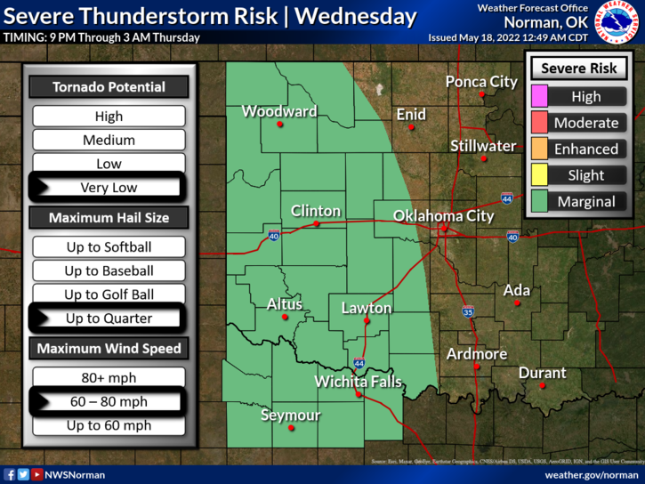
4-We are in a General Risk area for thunderstorms late tonight so IF they occur, winds and hail would be the main issues. Overall, we’ll be ok so just endure the next few days until the weekend and we’ll cool off some.
Just remember that May in Oklahoma, we can see freezing temps down in the 30s and high temps in the 100s. We have seen major flooding and tornado outbreaks during the month of May. These are a few of the facts about the weather in Oklahoma and why I push for you to be prepared. One day, extreme weather will affect you somewhere and you’ll look back and wish you had been prepared and ready for that extreme situation. Planning is only as difficult as you make it.
HAVE A GOOD DAY!