0325L-WEDNESDAY OUTLOOK FROM GARFIELD COUNTY EMERGENCY MANAGEMENT-11/18/20
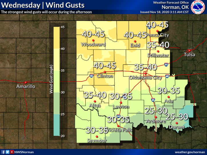
1-WIND ADVISORY FROM 11AM UNTIL 6PM- Wind gusts upwards of 40-45 mph are possible today through this evening. Dangers involved are sparking powerlines, broken branches still in trees that may fall along with weakened branches. Use EXTREME CAUTION while driving in crosswinds.
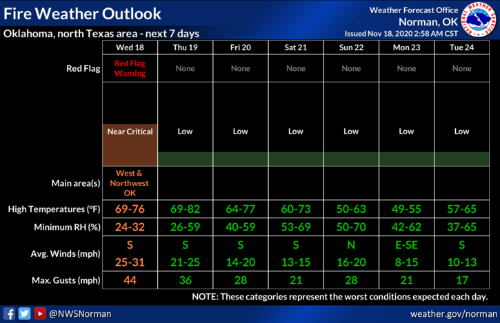
2- RED FLAG WARNING has been issued and is IN EFFECT FROM NOON UNTIL 6PM. A RED FLAG WARNING means that critical FIRE WEATHER CONDITIONS are occurring now or will shortly. A combination of strong winds, low relative humidity, and warm temps will contribute to extreme fire behavior.
3- NO CONTROLLED BURNING IS ADVISED TODAY AS MAJOR RANGE FIRES MAY OCCUR IF ANY BURNING GETS OUT OF CONTROL. Let’s not start any fires today.
4- Overall, a bad day to be outside if you don’t like wind, dirt, and whatever else can fly around. Use caution while outdoors. Here is your forecast from the NWS/NORMAN;
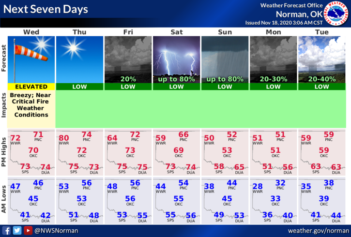
TODAY- Sunny with a high near 69. Windy with a south wind 15 to 20 mph increasing to 25 to 30 mph in the afternoon. Winds could gust as high as 45 mph.
TONIGHT- Mostly clear with a low around 54. South wind 15 to 20 mph, with gusts as high as 29 mph.
HAVE A GOOD DAY!!
MIKE