0400L-WEDNESDAY OUTLOOK & INFO FROM GARFIELD COUNTY EMERGENCY MANAGEMENT-11/20/19
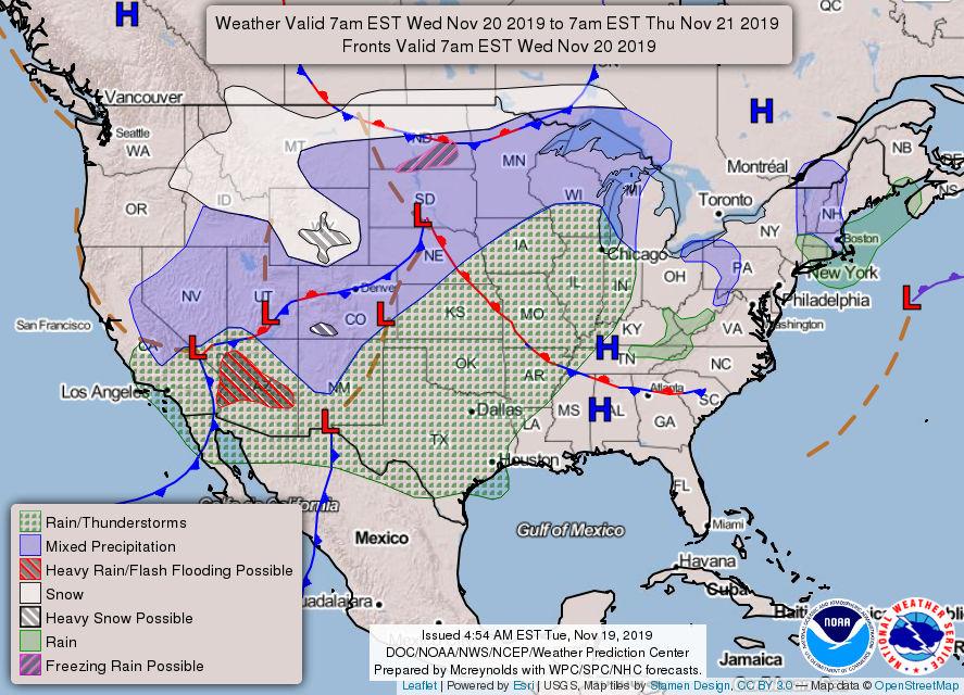
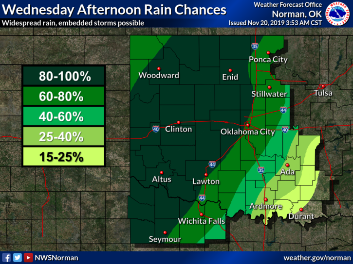
1- We are in a GENERAL THUNDERSTORM RISK area later today & tonight. We aren’t expecting anything severe but we could have some areas that receive heavy rainfall. If that does in fact occur, watch out for water over the roads in low lying areas. As for lightning and thunder, it might occur with the stronger cells along with some hail. Again, it depends where the heavier cells track. We’ll be ok so no need to panic. This storm system will track in from the west-southwest.
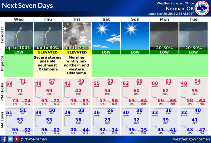
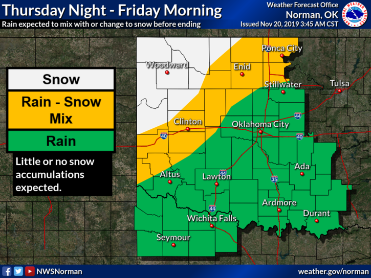
2- Another system will affect us later Thursday into Friday. Initially we’ll see rain then possibly transition to a winter mix depending on temps after a cold front pushes through. We’ll again have to wait and see how everything lines up so until then, no need to scramble for milk and bread!! We will survive!!
3- Be sure to get our app. You’ll receive advisories directly from the NWS & us so you’ll be on top of what’s happening. Our app GARFIELD COUNTY EM is PREPAREDNESS.
Here is your forecast from the NWS/NORMAN;
Today-A chance of rain showers early in the afternoon. Rain showers and isolated thunderstorms late in the afternoon. Highs in the lower 70s. South winds 15 to 25 mph.
Tonight-Mostly cloudy. A chance of rain showers and isolated thunderstorms in the evening. Lows in the upper 40s. Southwest winds 15 to 25 mph. Chance of precipitation 50 percent.
HAVE A SUPER DAY!!
MIKE