0330L-WEDNESDAY OUTLOOK FROM GARFIELD COUNTY EMERGENCY MANAGEMENT-10/20/21
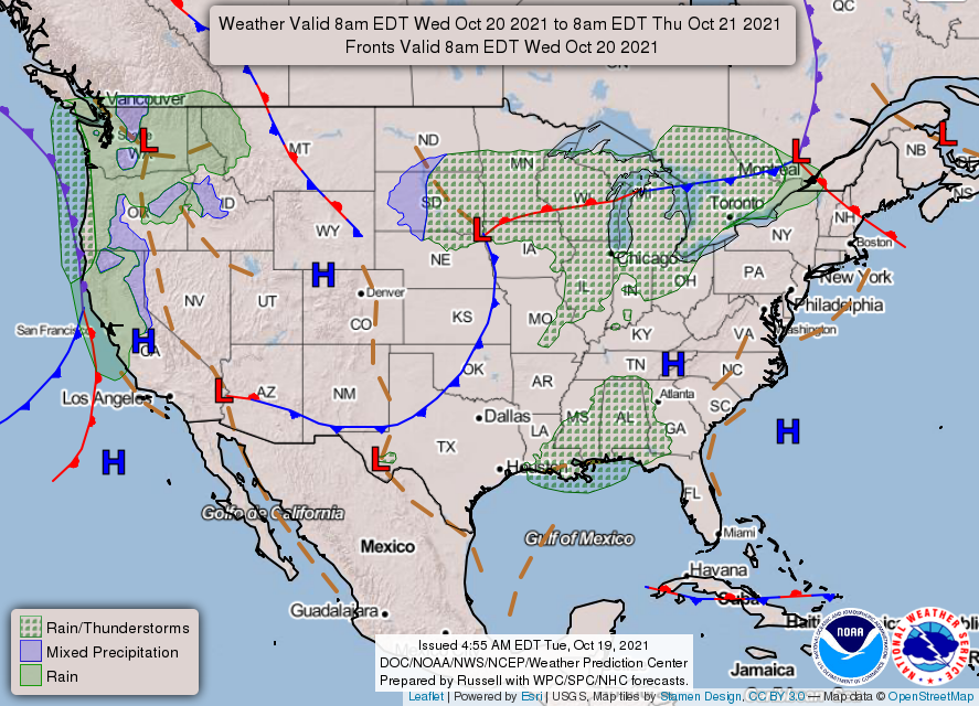
1-At 0300L we are pretty warm outdoors this morning. Its 65 and we have a cold front coming. It should be in the area between 06 to 0800L this morning. No storms, but winds will shift and become northerly gusting upwards around 25 mph or so. Other than this, not to bad for the day. Temps will be knocked back down to around seasonal averages. Overnight lows will be in the 40s.
2- This front will stall around the RED RIVER later tonight and start moving back northward as a warm front. Depending how far north it moves will depend on our rain chances Thursday evening into Friday. Not holding my breath quite yet.
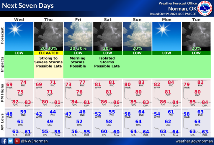
3- Next week could be interesting. It’s too soon to make a hard core determination but we could see some severe weather once again so make sure you are prepared. I would continue preparing for this winter too. Not expecting that for several weeks but it’ll be here before you know it. Here is your forecast from the NWS/NORMAN;
Wednesday-Sunny. Highs in the mid-70s. Northwest winds 10 to 15 mph with higher gusts.
Wednesday Night-Clear, colder. Lows in the mid-40s. Light and variable winds.
FINALLY- Download our GARFIELD COUNTY EM app. It’s loaded with information and notification capabilities. It just could possibly save your life.
STAY SAFE
MIKE