0350L-WEDNESDAY OUTLOOK FROM GARFIELD COUNTY EMERGENCY MANAGEMENT-9/30/2020
1-GARFIELD COUNTY EM is our notification app. If you don’t have it, you will need it and you’re NOT PREPARED without it.
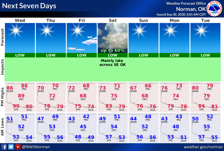
2- Another Front will move in around the late morning to early afternoon timeframe. Westerly winds will give way to northerly winds after the front comes through. We could see some wind gusts upwards of 20-25 mph. Bitterly cold air is NOT expected but you will notice our high & low temps the rest of the week being cooler.
3- Overall, we’ll be ok so get out and enjoy the warmer weather prior to the front pushing in. Once again, keep and eye out for fires as conditions could help that elevate. BY THE WAY, we may see some Smokey skies from the fires in northern Colorado as they work their way into the area since we are under northwest flow aloft.
4- Here is your forecast from the NWS/NORMAN;
Today- Sunny. Highs in the upper 80s. West winds around 10 mph shifting to the north in the afternoon.
Tonight- Clear. Lows around 50. Northeast winds around 10 mph in the evening becoming light and variable.
HAVE A GOOD DAY!!
MIKE