0345L-FRIDAY OUTLOOK FROM GARFIELD COUNTY EMERGENCY MANAGEMENT-2/12/21
1- WIND CHILL ADVISORY in effect FROM NOW until NOON on SATURDAY.
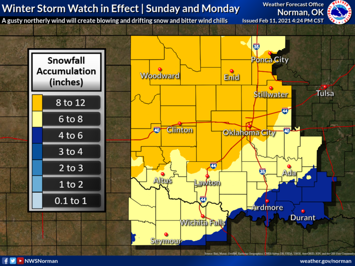
2-WINTER STORM WATCH in effect FROM LATER SATURDAY EVENING until Monday PM.
3- WIND CHILL TEMPS AS LOW AS -10 BELOW ZERO AND THEN SNOW ACCUMULATIONS FROM 6-10 INCHES POSSIBLE late this weekend. Travel may become very difficult to near impossible in some areas. The wind chill temps could cause frostbite in less than 30 minutes. Use EXTREME CAUTION if you have to be out as these are VERY DANGEROUS conditions. Remember that we may see blizzard conditions at times due to strong winds.
4- OVERALL, we are bitterly cold and this type of cold can kill so be very careful out there. Travel is NOT advised but if you do, be prepared just in case you have to spend time in the ditch or in a broken down vehicle. Hopefully, these things don’t happen.
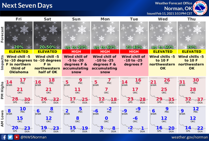
5- Here is your forecast from the NWS/NORMAN;
Friday-Mostly cloudy. Highs around 19. Northeast winds 10 to 15 mph.
Friday Night-Mostly cloudy. A chance of very light snow after midnight. Lows around 8. Northeast winds 10 to 15 mph. Chance of snow 10 percent.
STAY WARM AND HAVE A GOOD DAY!
MIKE