0320L-MONDAY OUTLOOK FROM GARFIELD COUNTY EMERGENCY MANAGEMENT-1/31/22
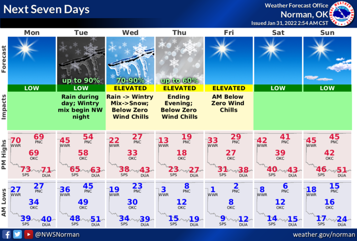
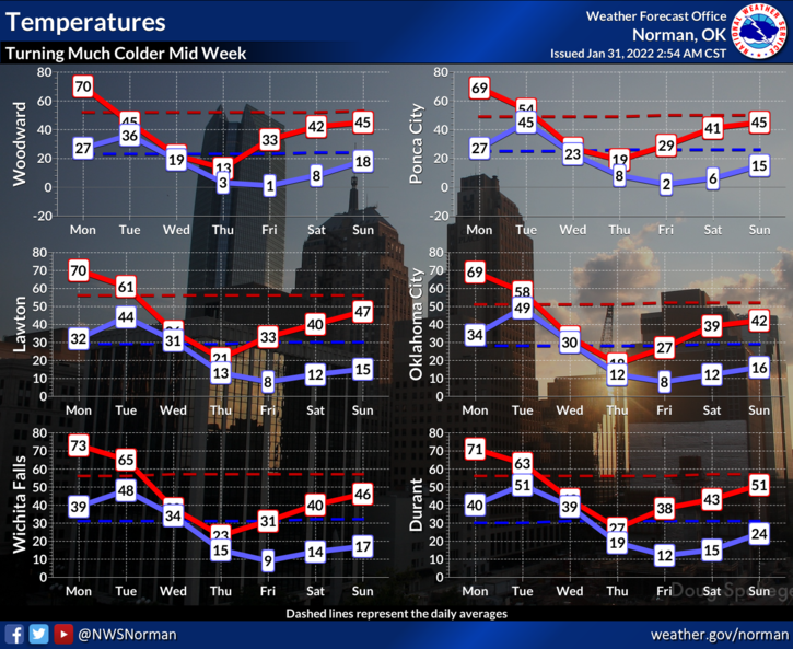
1- Remember when I said to enjoy the next few days? Remember to enjoy today since temps might get close to 70. After today, Tuesdays high will drop into the upper 40s to low 40s, Wednesday will be in the upper 20s and Thursday we’ll be in the upper teens. These are HIGH temps. Wednesday morning low-upper 20s, Thursday morning low-7, and Friday morning low around 3.
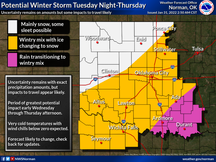
2-The above mentioned, we can expect rain on Tuesday then mostly snow on Wednesday and possibly some snow remaining on Thursday. Whatever amounts we do receive could range from 4-8 inches and this IS WORST CASE SCENARIO. MY “BIGGEST” CONCERN WILL BE THE WIND CHILL. WE’LL BE IN THE -15 TO -20 BELOW ZERO AREA. Make sure you have your animals and pets properly taken care of in the dangerously low temps.
3-If you plan on traveling when this mess occurs, change your plans now. Travel may be next to impossible in some areas where freezing rain may occur, just sayin. Use good common sense when making travel decisions.
4- After a briefing later this morning with the NWS, I may do a quick live broadcast on the EMERGENCY MANAGEMENT PAGE on facebook IF anything has changed dramatically since this writing. Remember that the FIRE DANGER is elevated out there so we ask that NO CONTROLLED BURNING be done this week. Thank you.
5- Here is your forecast for today from the NWS/NORMAN;
Monday-Sunny. Highs in the upper 60s. South winds up to 10 mph increasing to 10 to 15 mph in the afternoon gusting upwards of 24 mph.
Monday Night-Partly cloudy. Not as cool. Lows in the mid-40s. South winds 10 to 15 mph.
Stay safe!