0300L-SUNDAY OUTLOOK FROM GARFIELD COUNTY EMERGENCY MANAGEMENT 01/14/24
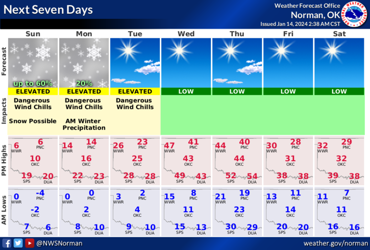
**WIND CHILL WARNING REMAINS IN EFFECT UNTIL NOON ON TUESDAY. WINTER WEATHER ADVISORY IS IN EFFECT FROM 0900 THIS MORNING UNTIL 1800L (6PM) THIS EVENING.
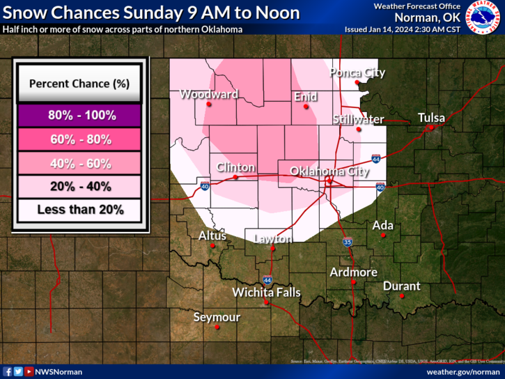
*Snow is expected today with “possible accumulation” of 1-3 inches which is why the Winter Advisory was issued.
*The above stated; It’s cold outside so take the proper precautions to prevent frostbite to yourself, the kids, and the pets. If we do see snow today and you have to get out and drive, slow down and be careful.
*Overall, we’ll be ok, just frozen so here is your forecast from the NWS/NORMAN;
Today- Snow likely. Total snow accumulation of 1 to 3 inches. Cold with highs around 7 above. Northeast winds 5 to 10 mph. Chance of snow 60 percent. Wind chill values as low as 17 below.
Tonight- Mostly cloudy. A slight chance of snow after midnight. Cold with lows around 1 above. Northeast winds 5 to 10 mph. Chance of snow 20 percent. Wind chill values as low as 12 below.
*FINALLY, we could see temps by mid-week in the 40s before another arctic front comes in on Thursday affecting next weekend. We’ll see what happens.
STAY WARM AND HAVE A GOOD DAY!