0255L-MONDAY OUTLOOK FROM GARFIELD COUNTY EMERGENCY MANAGEMENT 01/15/24
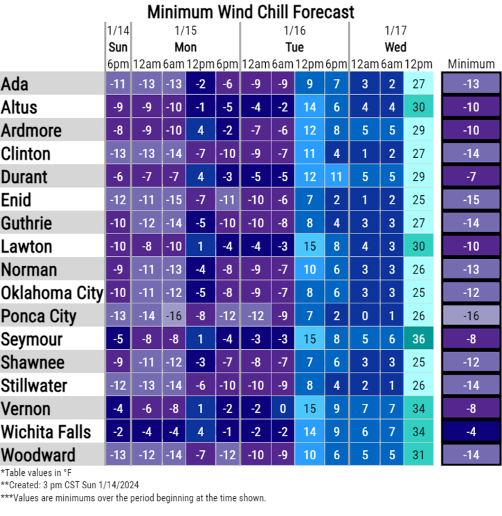
**WIND CHILL WARNING REMAINS IN EFFECT UNTIL NOON TODAY THEN A WIND CHILL ADVISORY WILL BE IN EFFECT FROM NOON TODAY UNTIL NOON TUESDAY.
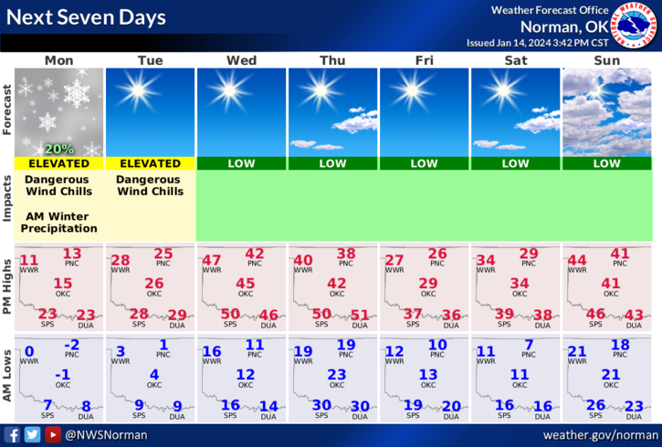
*We’re going to warm up with highs in the low teens but unfortunately with wind. The wind will keep our wind chill temps below zero so continue to bundle up if going outside. There is a chance we’ll see flurries early this morning, possibly during the day into tonight. We should get above freezing on Wednesday before another arctic front pushes in on Thursday. The air associated with Thursdays front shouldn’t be as cold as this one but will affect temps next weekend.
*Look at the bright side, we’re halfway through January and summer really isn’t too far away. Overall, we’ll be ok, just a bit cold so here’s your forecast from the NWS/NORMAN;
Today- Partly sunny. Cold with highs around 13. North winds 10 to 15 mph. Wind chill values as low as 14 below.
Tonight- Mostly cloudy with a slight chance of snow in the evening, then partly cloudy after midnight. Cold with lows around 2 above. Northwest winds 10 to 15 mph. Chance of snow 20 percent. Wind chill values as low as 9 below.
STAY WARM AND HAVE A GOOD DAY!