1900 LOCAL TIME SUNDAY EVENING UPDATE FROM ENID/GARFIELD COUNTY EMERGENCY MANAGEMENT.
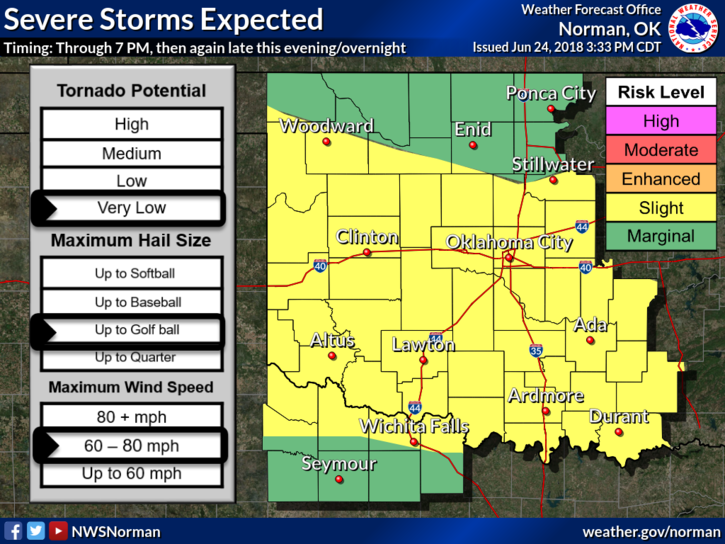
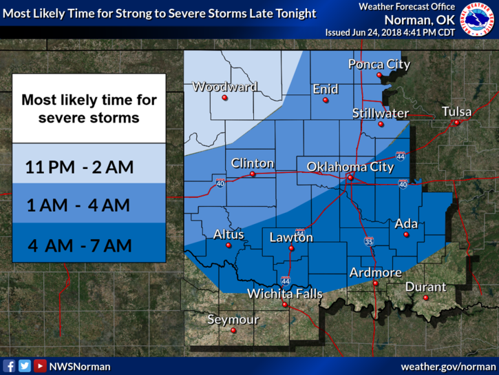
1- WE EXPECT ANOTHER ROUND OF SEVERE WEATHER LATE TONIGHT. TIMING IS ROUGHLY FROM 0100-0400 LOCAL TIME. Strong winds possibly to 80 mph and hail possibly to the size of golf balls are possible along with torrential rainfall.
2- There will most likely be a threat for some localized flooding so be careful out there if you happen to be driving around.
3-Since the rain today really worked over the atmosphere we can only hope that storms move into a more stable environment thus lessening the effect. We’ll see what happens.
4- THE WIND EVENT THAT HIT US EARLIER THIS AFTERNOON IS CALLED A “WAKE LOW EVENT” PER GUIDANCE FROM THE NWS. You can find the information here- https://en.wikipedia.org/wiki/Wake_low
5- There has been substantial damage all around the county from this event. As stated from an earlier post, if you had structural damage, let me know and I will come see you tomorrow. I saw quite a few folks this afternoon so hopefully everyone has their insurance up to date.
HAVE A GOOD EVENING!!
MIKE