0355L-SUNDAY UPDATE FROM ENID/GARFIELD COUNTY EMERGENCY MANAGEMENT-6/24/18
1- AT 0320 THIS MORNING WE HAVE BEEN DEALING WITH SEVERE WEATHER. THE MAIN ISSUE HAS BEEN THE WIND. WE’VE HAVE HAD WIND GUSTS UP TO 74 MPH PER THE BRECKENRIDGE MESONET SITE AS OF RIGHT NOW. WIND GUSTS FROM VAFB WERE AT 67MPH. I HAVE HAD NO REPORTS OF MAJOR DAMAGE FROM ANYONE OTHER THAN SOME POWERLINES DOWN IN A FEW AREAS.
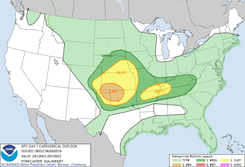
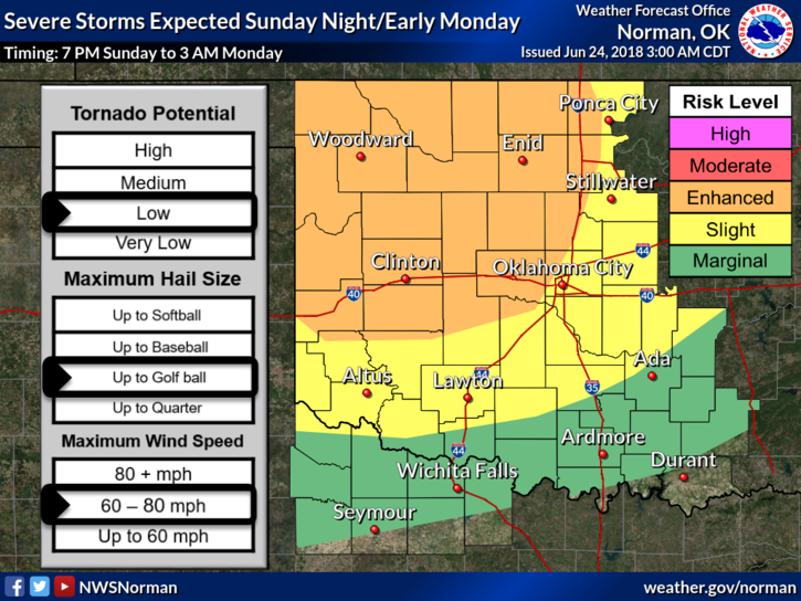
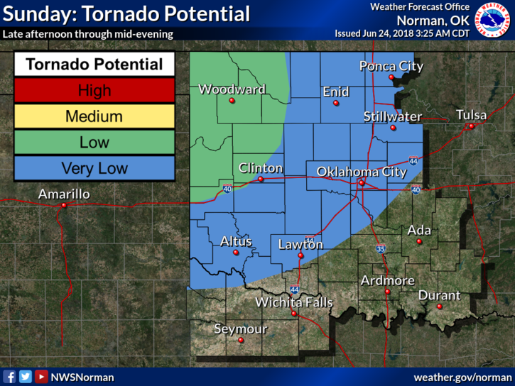
2- We will focus on later today now. We are in an ENHANCED RISK for severe weather later today and tonight. Storms will form from Nebraska into Northern Oklahoma. These storms will be capable of winds 60-80 mph, golf ball size hail and a low tornado threat. Timing will be from roughly 1900L (7pm) through 0300L Monday morning. Basically close to what we have experienced the last few nights. HEAT will be an issue TODAY so be careful outdoors.
3- Overall, we’ll be ok. Just remember to secure anything that could take flight as these winds have been a bit tough the last few evenings.
4- Several have stated they are not receiving alerts over the app. This could be from your operating system on your phone to an old version of the app. If this is occurring, delete the app and download it again. I will send an advisory message around mid-afternoon as a test for those that do this but with the latest info on the up and coming severe weather threat. Try this first and TEXT ME your findings. 5805411263.
5- Here is your forecast from the NWS/NORMAN;
Sunday-Showers and thunderstorms likely, mainly before 7am. Mostly cloudy, with a high near 90. Heat index values as high as 97. South wind 9 to 17 mph, with gusts as high as 24 mph. Chance of precipitation is 60%. New rainfall amounts between a quarter and half of an inch possible.
Sunday Night-Showers and thunderstorms. Some of the storms could be severe. Low around 67. South southeast wind 10 to 20 mph, with gusts as high as 25 mph. Chance of precipitation is 80%. New rainfall amounts between 2 and 3 inches possible.
HAVE A SUPER DAY!!
MIKE