0400L-TUESDAY OUTLOOK & INFO FROM ENID/GARFIELD COUNTY EMERGENCY MANAGEMENT-2/12/19
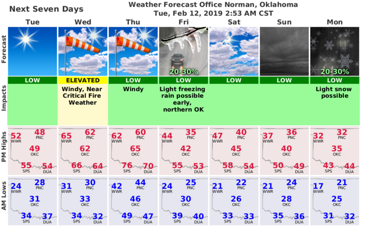
1) Cool today and becoming windy. Keep a coat handy depending what you may be doing outside. Warmer temps coming Wednesday & Thursday along with ample sunshine then the bottom falls out some.
2) There have been some signs that a strong storm system may show up around the first of the week. Details are very sketchy right now and that system is WAY OUT THERE!! Better details will be forthcoming as this week progresses. Snow is in that forecast but only at 20%. We’ll see what happens. Over the weekend, we may see a chance for snow but those chances are only at 20% too.
3) Overall, the next few days will have abundant sunshine so get out and enjoy it before it disappears again on Friday.
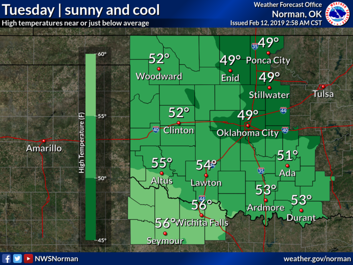
4) Here is your forecast from the NWS/NORMAN;
Tuesday- Sunny with a high near 49. Northwest winds 5 to 15 mph.
Tuesday Night-Clear with a low around 32. West winds 5 to 15 mph becoming south in the evening. Winds could gust as high as 20 mph.
HAVE A SUPER DAY!!
MIKE