0400L-WEDNESDAY OUTLOOK & INFO FROM GARFIELD COUNTY EMERGENCY MANAGEMENT-2/13/19
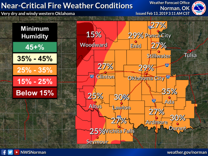
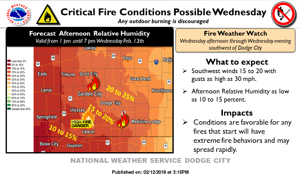
Two words of the day: WINDY AND WARM. FIRE DANGER would be two more.
1) We will warm up and the wind will blow thus the increased fire danger. The danger will be higher out west but either way, if you see smoke or fire, CALL 911.
2) CONTROLLED BURNING IS “NOT” ADVISED TODAY.
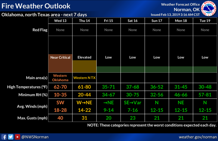
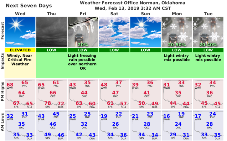
3) After a few days of warm windy weather, we shift to colder windy weather and a SLIGHT chance for some winter precip. Those chances are low for now so we’ll see how the models work this mess out. As of right now, models are not in agreement so don’t let any hype out there get you upset. DAY BY DAY with facts is what I go with.
4) For now, enjoy the warmer weather because it will change and here is your forecast from the NWS/NORMAN;
Wednesday-Mostly sunny, with a high near 65. South southwest wind 14 to 23 mph, with gusts as high as 32 mph.
Wednesday Night-Partly cloudy, with a low around 46. South wind 16 to 22 mph, with gusts as high as 31 mph.
HAVE A SUPER DAY!!
MIKE