0403L-FRIDAY OUTLOOK AND INFO FROM GARFIELD CO. EMERGENCY MANAGEMENT-8/2/19
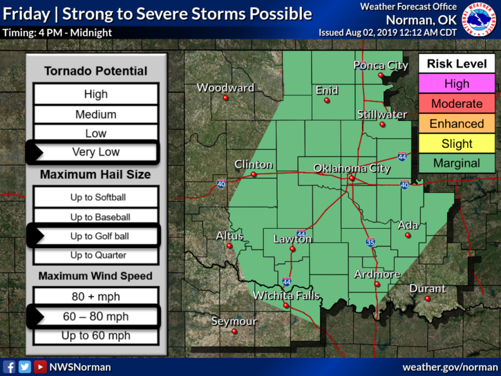
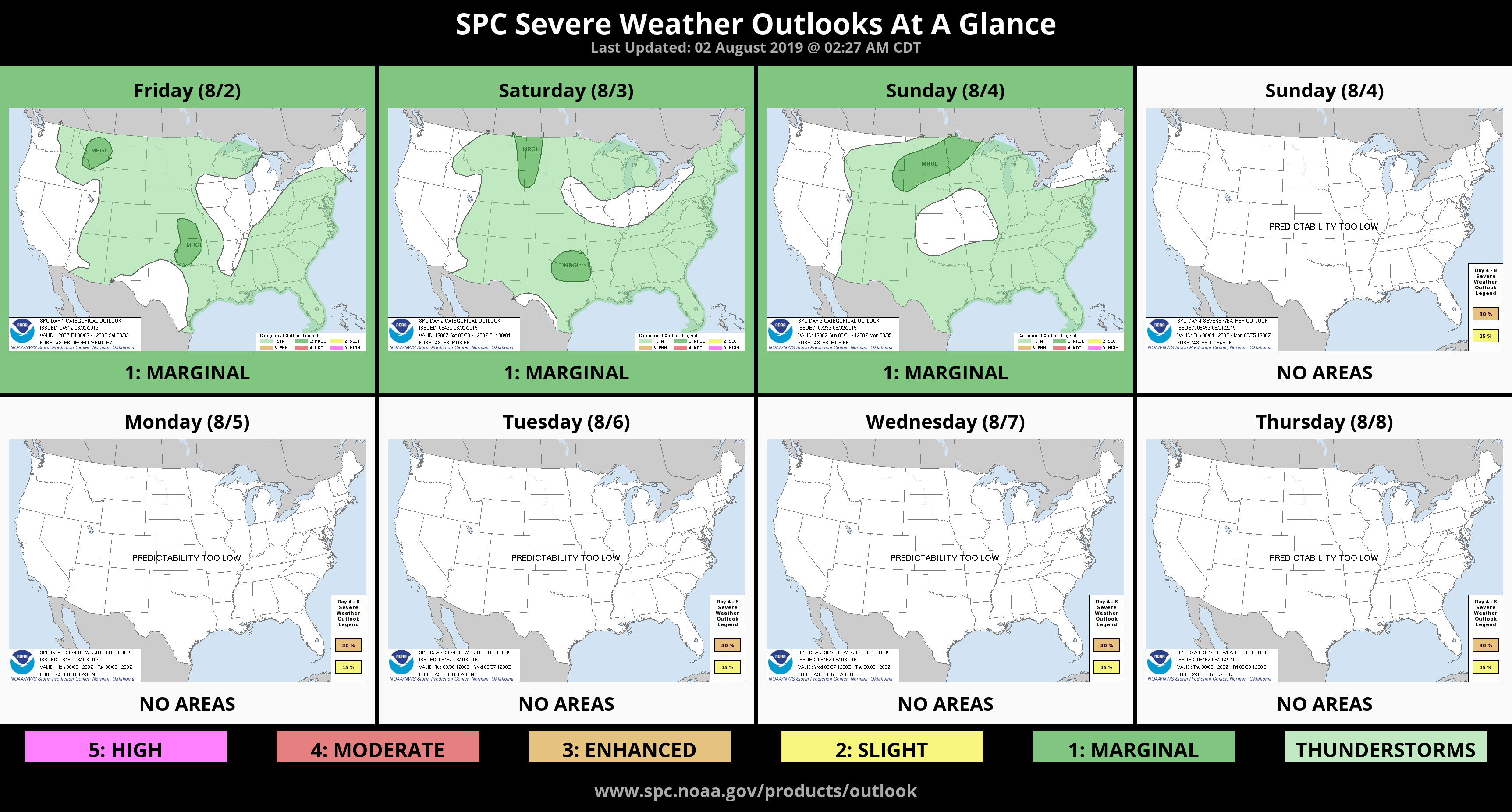
1- MARGINAL RISK for severe weather later today and tonight. Main threats will be hail and winds. There is a low possibility of a tornado if conditions allow. We will be in a very unstable environment so we’ll see how this mess comes together. There is a good chance for thunderstorms this morning too. Gusty winds, hail, and torrential rainfall are possible.
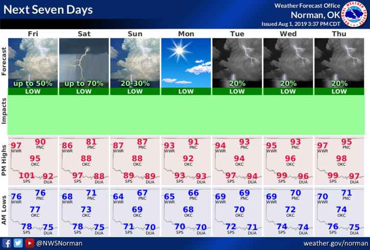
2- Here is your forecast from the NWS/NORMAN;
Friday- 20% chance of showers and thunderstorms before 7am and a chance this afternoon. Partly sunny and hot with a high near 99. Heat index around 104. South southeast winds 10 to 20 mph gusting to 25 mph.
Friday Night-40% chance of showers and thunderstorms. Low around 71. South southeast wind 5 to 15 mph becoming east northeast after midnight. Winds could gust as high as 20 mph.
3- If you haven’t downloaded our GARFIELD COUNTY EM app, never complain that you didn’t know what was going on weather or major incident-wise. NWS advisories and warnings are automatic and major incident info comes from us when necessary. You are better prepared with it than without it.
HAVE A GREAT DAY!!
MIKE